You are here: Home > Network List > TA - USArray Transportable Network (new EarthScope stations) Stations List
> Station R11A Troy Canyon, Currant, NV, USA > Earthquake Result Viewer
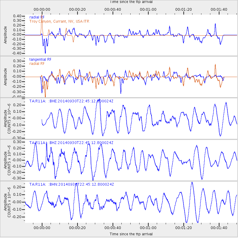
R11A Troy Canyon, Currant, NV, USA - Earthquake Result Viewer
*The percent match for this event was below the threshold and hence no stack was calculated.
| Earthquake location: |
Fiji Islands Region |
| Earthquake latitude/longitude: |
-17.8/-178.6 |
| Earthquake time(UTC): |
2014/09/30 (273) 22:34:27 GMT |
| Earthquake Depth: |
574 km |
| Earthquake Magnitude: |
5.5 MWP |
| Earthquake Catalog/Contributor: |
NEIC PDE/NEIC COMCAT |
|
| Network: |
TA USArray Transportable Network (new EarthScope stations) |
| Station: |
R11A Troy Canyon, Currant, NV, USA |
| Lat/Lon: |
38.35 N/115.59 W |
| Elevation: |
1756 m |
|
| Distance: |
81.3 deg |
| Az: |
45.144 deg |
| Baz: |
239.191 deg |
| Ray Param: |
$rayparam |
*The percent match for this event was below the threshold and hence was not used in the summary stack. |
|
| Radial Match: |
62.037273 % |
| Radial Bump: |
400 |
| Transverse Match: |
58.715378 % |
| Transverse Bump: |
400 |
| SOD ConfigId: |
796777 |
| Insert Time: |
2014-10-14 23:11:26.022 +0000 |
| GWidth: |
2.5 |
| Max Bumps: |
400 |
| Tol: |
0.001 |
|
Signal To Noise
| Channel | StoN | STA | LTA |
| TA:R11A: :BHZ:20140930T22:45:12.800024Z | 0.98393744 | 1.06281995E-7 | 1.08017026E-7 |
| TA:R11A: :BHN:20140930T22:45:12.800024Z | 0.996856 | 9.399466E-8 | 9.429111E-8 |
| TA:R11A: :BHE:20140930T22:45:12.800024Z | 2.1033359 | 2.1145476E-7 | 1.0053305E-7 |
| Arrivals |
| Ps | |
| PpPs | |
| PsPs/PpSs | |


