You are here: Home > Network List > UW - Pacific Northwest Regional Seismic Network Stations List
> Station LEBA Lebam, WA, USA > Earthquake Result Viewer
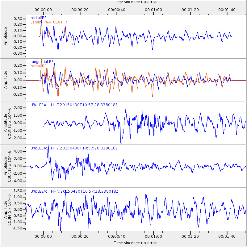
LEBA Lebam, WA, USA - Earthquake Result Viewer
*The percent match for this event was below the threshold and hence no stack was calculated.
| Earthquake location: |
New Britain Region, P.N.G. |
| Earthquake latitude/longitude: |
-5.5/151.8 |
| Earthquake time(UTC): |
2015/04/30 (120) 10:45:06 GMT |
| Earthquake Depth: |
60 km |
| Earthquake Magnitude: |
6.8 MWP, 6.8 MI |
| Earthquake Catalog/Contributor: |
NEIC PDE/NEIC COMCAT |
|
| Network: |
UW Pacific Northwest Regional Seismic Network |
| Station: |
LEBA Lebam, WA, USA |
| Lat/Lon: |
46.55 N/123.56 W |
| Elevation: |
73 m |
|
| Distance: |
90.2 deg |
| Az: |
43.406 deg |
| Baz: |
262.367 deg |
| Ray Param: |
$rayparam |
*The percent match for this event was below the threshold and hence was not used in the summary stack. |
|
| Radial Match: |
62.305073 % |
| Radial Bump: |
400 |
| Transverse Match: |
64.53649 % |
| Transverse Bump: |
400 |
| SOD ConfigId: |
7422571 |
| Insert Time: |
2019-04-18 14:50:07.828 +0000 |
| GWidth: |
2.5 |
| Max Bumps: |
400 |
| Tol: |
0.001 |
|
Signal To Noise
| Channel | StoN | STA | LTA |
| UW:LEBA: :HHZ:20150430T10:57:28.338018Z | 7.2842917 | 2.1582828E-6 | 2.9629274E-7 |
| UW:LEBA: :HHN:20150430T10:57:28.338018Z | 1.0557934 | 4.2121982E-7 | 3.9896048E-7 |
| UW:LEBA: :HHE:20150430T10:57:28.338018Z | 1.9875476 | 6.183339E-7 | 3.1110395E-7 |
| Arrivals |
| Ps | |
| PpPs | |
| PsPs/PpSs | |


