You are here: Home > Network List > TA - USArray Transportable Network (new EarthScope stations) Stations List
> Station MDND Maddock, ND, USA > Earthquake Result Viewer
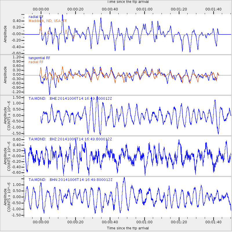
MDND Maddock, ND, USA - Earthquake Result Viewer
*The percent match for this event was below the threshold and hence no stack was calculated.
| Earthquake location: |
Mariana Islands Region |
| Earthquake latitude/longitude: |
15.5/147.3 |
| Earthquake time(UTC): |
2014/10/06 (279) 14:04:05 GMT |
| Earthquake Depth: |
6.9 km |
| Earthquake Magnitude: |
5.6 MB |
| Earthquake Catalog/Contributor: |
NEIC PDE/NEIC ALERT |
|
| Network: |
TA USArray Transportable Network (new EarthScope stations) |
| Station: |
MDND Maddock, ND, USA |
| Lat/Lon: |
47.85 N/99.60 W |
| Elevation: |
479 m |
|
| Distance: |
93.4 deg |
| Az: |
38.357 deg |
| Baz: |
297.331 deg |
| Ray Param: |
$rayparam |
*The percent match for this event was below the threshold and hence was not used in the summary stack. |
|
| Radial Match: |
45.26785 % |
| Radial Bump: |
367 |
| Transverse Match: |
57.818096 % |
| Transverse Bump: |
400 |
| SOD ConfigId: |
796777 |
| Insert Time: |
2014-10-20 14:33:46.403 +0000 |
| GWidth: |
2.5 |
| Max Bumps: |
400 |
| Tol: |
0.001 |
|
Signal To Noise
| Channel | StoN | STA | LTA |
| TA:MDND: :BHZ:20141006T14:16:49.800012Z | 1.0655024 | 1.9607944E-7 | 1.8402534E-7 |
| TA:MDND: :BHN:20141006T14:16:49.800012Z | 1.1658069 | 7.229084E-7 | 6.2009275E-7 |
| TA:MDND: :BHE:20141006T14:16:49.800012Z | 3.2307153 | 1.1243616E-6 | 3.480225E-7 |
| Arrivals |
| Ps | |
| PpPs | |
| PsPs/PpSs | |


