You are here: Home > Network List > US - United States National Seismic Network Stations List
> Station HAWA Hanford, Washington, USA > Earthquake Result Viewer
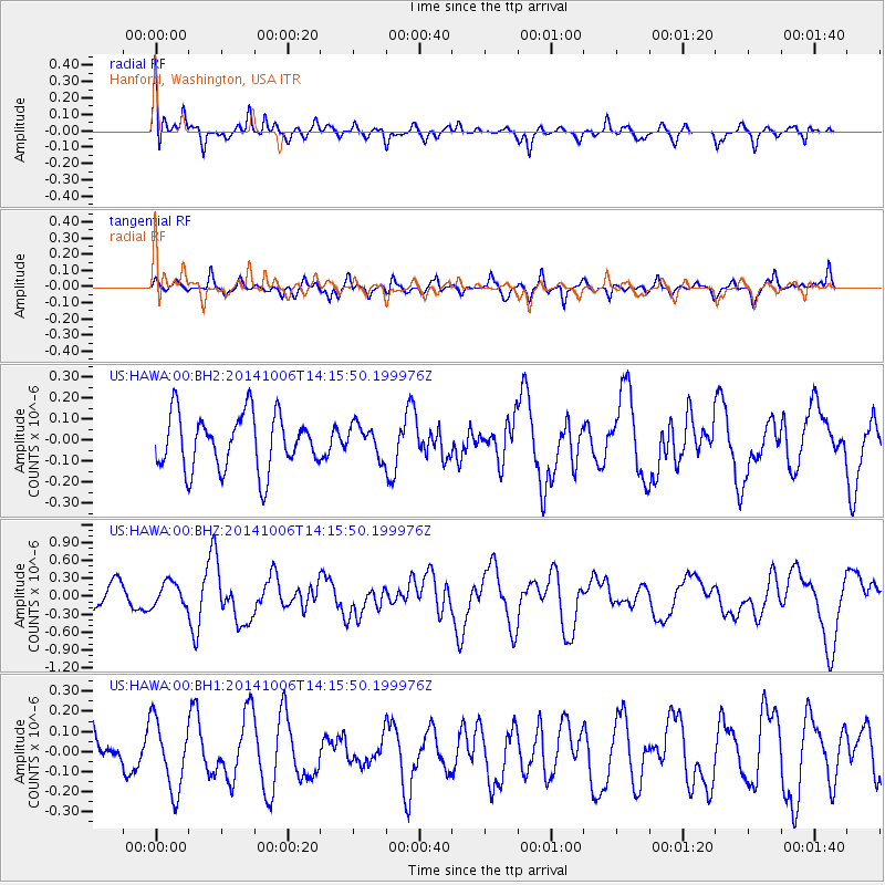
HAWA Hanford, Washington, USA - Earthquake Result Viewer
*The percent match for this event was below the threshold and hence no stack was calculated.
| Earthquake location: |
Mariana Islands Region |
| Earthquake latitude/longitude: |
15.5/147.3 |
| Earthquake time(UTC): |
2014/10/06 (279) 14:04:05 GMT |
| Earthquake Depth: |
6.9 km |
| Earthquake Magnitude: |
5.6 MB |
| Earthquake Catalog/Contributor: |
NEIC PDE/NEIC ALERT |
|
| Network: |
US United States National Seismic Network |
| Station: |
HAWA Hanford, Washington, USA |
| Lat/Lon: |
46.39 N/119.53 W |
| Elevation: |
364 m |
|
| Distance: |
81.1 deg |
| Az: |
44.38 deg |
| Baz: |
282.992 deg |
| Ray Param: |
$rayparam |
*The percent match for this event was below the threshold and hence was not used in the summary stack. |
|
| Radial Match: |
75.88244 % |
| Radial Bump: |
400 |
| Transverse Match: |
68.19717 % |
| Transverse Bump: |
400 |
| SOD ConfigId: |
796777 |
| Insert Time: |
2014-10-20 14:35:06.980 +0000 |
| GWidth: |
2.5 |
| Max Bumps: |
400 |
| Tol: |
0.001 |
|
Signal To Noise
| Channel | StoN | STA | LTA |
| US:HAWA:00:BHZ:20141006T14:15:50.199976Z | 0.9449762 | 2.0135899E-7 | 2.1308367E-7 |
| US:HAWA:00:BH1:20141006T14:15:50.199976Z | 1.7439603 | 1.7090643E-7 | 9.7999035E-8 |
| US:HAWA:00:BH2:20141006T14:15:50.199976Z | 0.57951164 | 7.580399E-8 | 1.3080667E-7 |
| Arrivals |
| Ps | |
| PpPs | |
| PsPs/PpSs | |


