You are here: Home > Network List > WY - Yellowstone Wyoming Seismic Network Stations List
> Station YHR Hawk's Rest, WY, USA > Earthquake Result Viewer
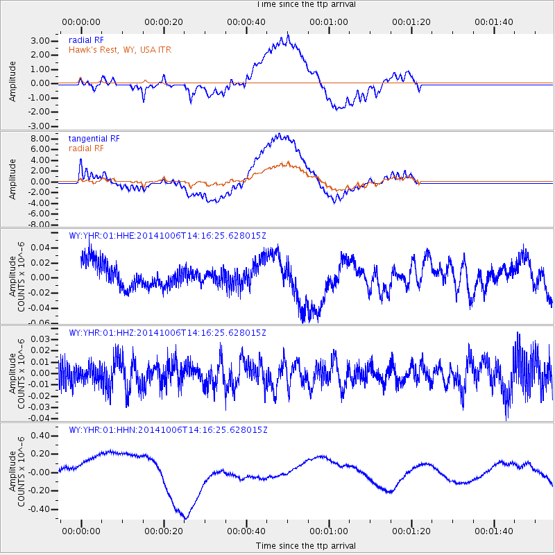
YHR Hawk's Rest, WY, USA - Earthquake Result Viewer
*The percent match for this event was below the threshold and hence no stack was calculated.
| Earthquake location: |
Mariana Islands Region |
| Earthquake latitude/longitude: |
15.5/147.3 |
| Earthquake time(UTC): |
2014/10/06 (279) 14:04:05 GMT |
| Earthquake Depth: |
6.9 km |
| Earthquake Magnitude: |
5.6 MB |
| Earthquake Catalog/Contributor: |
NEIC PDE/NEIC ALERT |
|
| Network: |
WY Yellowstone Wyoming Seismic Network |
| Station: |
YHR Hawk's Rest, WY, USA |
| Lat/Lon: |
44.11 N/110.08 W |
| Elevation: |
2976 m |
|
| Distance: |
88.2 deg |
| Az: |
44.69 deg |
| Baz: |
289.719 deg |
| Ray Param: |
$rayparam |
*The percent match for this event was below the threshold and hence was not used in the summary stack. |
|
| Radial Match: |
27.251583 % |
| Radial Bump: |
400 |
| Transverse Match: |
25.862282 % |
| Transverse Bump: |
400 |
| SOD ConfigId: |
796777 |
| Insert Time: |
2014-10-20 14:37:22.557 +0000 |
| GWidth: |
2.5 |
| Max Bumps: |
400 |
| Tol: |
0.001 |
|
Signal To Noise
| Channel | StoN | STA | LTA |
| WY:YHR:01:HHZ:20141006T14:16:25.628015Z | 0.7389607 | 6.3073853E-9 | 8.535482E-9 |
| WY:YHR:01:HHN:20141006T14:16:25.628015Z | 5.07554 | 2.54567E-7 | 5.0155645E-8 |
| WY:YHR:01:HHE:20141006T14:16:25.628015Z | 0.4575308 | 7.1597834E-9 | 1.5648746E-8 |
| Arrivals |
| Ps | |
| PpPs | |
| PsPs/PpSs | |


