You are here: Home > Network List > TA - USArray Transportable Network (new EarthScope stations) Stations List
> Station MDND Maddock, ND, USA > Earthquake Result Viewer
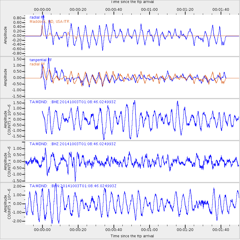
MDND Maddock, ND, USA - Earthquake Result Viewer
*The percent match for this event was below the threshold and hence no stack was calculated.
| Earthquake location: |
Near East Coast Of Honshu, Japan |
| Earthquake latitude/longitude: |
40.2/142.8 |
| Earthquake time(UTC): |
2014/10/03 (276) 00:57:30 GMT |
| Earthquake Depth: |
30 km |
| Earthquake Magnitude: |
5.5 MWW, 5.5 MWB, 5.6 MWC |
| Earthquake Catalog/Contributor: |
NEIC PDE/NEIC COMCAT |
|
| Network: |
TA USArray Transportable Network (new EarthScope stations) |
| Station: |
MDND Maddock, ND, USA |
| Lat/Lon: |
47.85 N/99.60 W |
| Elevation: |
479 m |
|
| Distance: |
76.4 deg |
| Az: |
37.881 deg |
| Baz: |
315.682 deg |
| Ray Param: |
$rayparam |
*The percent match for this event was below the threshold and hence was not used in the summary stack. |
|
| Radial Match: |
60.10208 % |
| Radial Bump: |
400 |
| Transverse Match: |
71.499725 % |
| Transverse Bump: |
366 |
| SOD ConfigId: |
796777 |
| Insert Time: |
2014-10-21 01:45:33.699 +0000 |
| GWidth: |
2.5 |
| Max Bumps: |
400 |
| Tol: |
0.001 |
|
Signal To Noise
| Channel | StoN | STA | LTA |
| TA:MDND: :BHZ:20141003T01:08:46.024993Z | 3.3731184 | 5.266774E-7 | 1.561396E-7 |
| TA:MDND: :BHN:20141003T01:08:46.024993Z | 1.2595141 | 1.1296778E-6 | 8.969155E-7 |
| TA:MDND: :BHE:20141003T01:08:46.024993Z | 1.4812937 | 8.9402107E-7 | 6.0354074E-7 |
| Arrivals |
| Ps | |
| PpPs | |
| PsPs/PpSs | |


