You are here: Home > Network List > TA - USArray Transportable Network (new EarthScope stations) Stations List
> Station R11A Troy Canyon, Currant, NV, USA > Earthquake Result Viewer
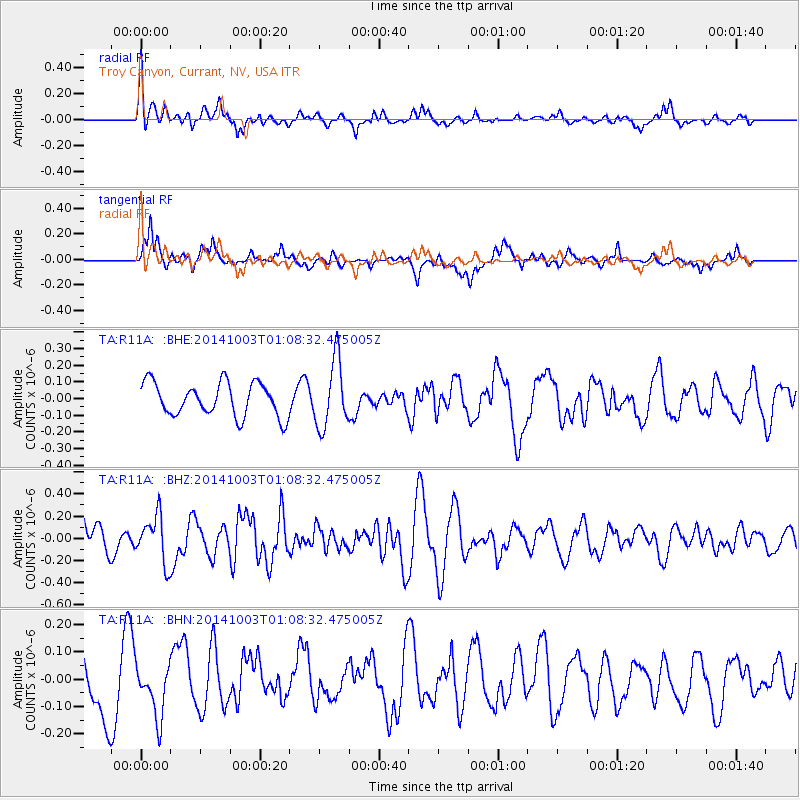
R11A Troy Canyon, Currant, NV, USA - Earthquake Result Viewer
*The percent match for this event was below the threshold and hence no stack was calculated.
| Earthquake location: |
Near East Coast Of Honshu, Japan |
| Earthquake latitude/longitude: |
40.2/142.8 |
| Earthquake time(UTC): |
2014/10/03 (276) 00:57:30 GMT |
| Earthquake Depth: |
30 km |
| Earthquake Magnitude: |
5.5 MWW, 5.5 MWB, 5.6 MWC |
| Earthquake Catalog/Contributor: |
NEIC PDE/NEIC COMCAT |
|
| Network: |
TA USArray Transportable Network (new EarthScope stations) |
| Station: |
R11A Troy Canyon, Currant, NV, USA |
| Lat/Lon: |
38.35 N/115.59 W |
| Elevation: |
1756 m |
|
| Distance: |
74.0 deg |
| Az: |
53.228 deg |
| Baz: |
308.668 deg |
| Ray Param: |
$rayparam |
*The percent match for this event was below the threshold and hence was not used in the summary stack. |
|
| Radial Match: |
64.1501 % |
| Radial Bump: |
400 |
| Transverse Match: |
62.709312 % |
| Transverse Bump: |
365 |
| SOD ConfigId: |
796777 |
| Insert Time: |
2014-10-21 01:46:21.445 +0000 |
| GWidth: |
2.5 |
| Max Bumps: |
400 |
| Tol: |
0.001 |
|
Signal To Noise
| Channel | StoN | STA | LTA |
| TA:R11A: :BHZ:20141003T01:08:32.475005Z | 1.170602 | 2.0955315E-7 | 1.7901316E-7 |
| TA:R11A: :BHN:20141003T01:08:32.475005Z | 0.58938754 | 9.440337E-8 | 1.6017198E-7 |
| TA:R11A: :BHE:20141003T01:08:32.475005Z | 2.044919 | 2.0318161E-7 | 9.935924E-8 |
| Arrivals |
| Ps | |
| PpPs | |
| PsPs/PpSs | |


