You are here: Home > Network List > US - United States National Seismic Network Stations List
> Station AMTX Amarillo, Texas, USA > Earthquake Result Viewer
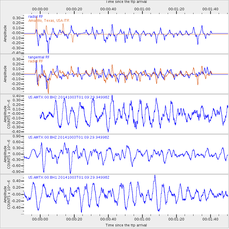
AMTX Amarillo, Texas, USA - Earthquake Result Viewer
*The percent match for this event was below the threshold and hence no stack was calculated.
| Earthquake location: |
Near East Coast Of Honshu, Japan |
| Earthquake latitude/longitude: |
40.2/142.8 |
| Earthquake time(UTC): |
2014/10/03 (276) 00:57:30 GMT |
| Earthquake Depth: |
30 km |
| Earthquake Magnitude: |
5.5 MWW, 5.5 MWB, 5.6 MWC |
| Earthquake Catalog/Contributor: |
NEIC PDE/NEIC COMCAT |
|
| Network: |
US United States National Seismic Network |
| Station: |
AMTX Amarillo, Texas, USA |
| Lat/Lon: |
34.53 N/101.41 W |
| Elevation: |
1010 m |
|
| Distance: |
85.0 deg |
| Az: |
48.243 deg |
| Baz: |
316.173 deg |
| Ray Param: |
$rayparam |
*The percent match for this event was below the threshold and hence was not used in the summary stack. |
|
| Radial Match: |
58.218903 % |
| Radial Bump: |
313 |
| Transverse Match: |
62.166203 % |
| Transverse Bump: |
400 |
| SOD ConfigId: |
796777 |
| Insert Time: |
2014-10-21 01:48:16.083 +0000 |
| GWidth: |
2.5 |
| Max Bumps: |
400 |
| Tol: |
0.001 |
|
Signal To Noise
| Channel | StoN | STA | LTA |
| US:AMTX:00:BHZ:20141003T01:09:29.94998Z | 2.627828 | 4.2311538E-7 | 1.6101335E-7 |
| US:AMTX:00:BH1:20141003T01:09:29.94998Z | 1.4788228 | 2.1705199E-7 | 1.467735E-7 |
| US:AMTX:00:BH2:20141003T01:09:29.94998Z | 0.85695624 | 1.4240123E-7 | 1.6617095E-7 |
| Arrivals |
| Ps | |
| PpPs | |
| PsPs/PpSs | |


