You are here: Home > Network List > US - United States National Seismic Network Stations List
> Station MSO Missoula, Montana, USA > Earthquake Result Viewer
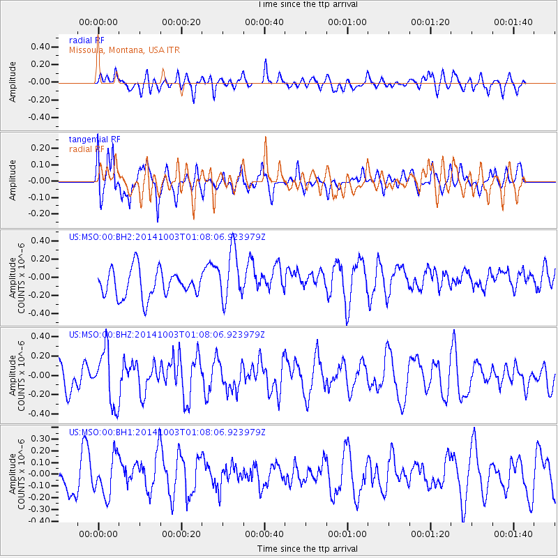
MSO Missoula, Montana, USA - Earthquake Result Viewer
*The percent match for this event was below the threshold and hence no stack was calculated.
| Earthquake location: |
Near East Coast Of Honshu, Japan |
| Earthquake latitude/longitude: |
40.2/142.8 |
| Earthquake time(UTC): |
2014/10/03 (276) 00:57:30 GMT |
| Earthquake Depth: |
30 km |
| Earthquake Magnitude: |
5.5 MWW, 5.5 MWB, 5.6 MWC |
| Earthquake Catalog/Contributor: |
NEIC PDE/NEIC COMCAT |
|
| Network: |
US United States National Seismic Network |
| Station: |
MSO Missoula, Montana, USA |
| Lat/Lon: |
46.83 N/113.94 W |
| Elevation: |
1264 m |
|
| Distance: |
69.8 deg |
| Az: |
45.417 deg |
| Baz: |
307.346 deg |
| Ray Param: |
$rayparam |
*The percent match for this event was below the threshold and hence was not used in the summary stack. |
|
| Radial Match: |
43.001278 % |
| Radial Bump: |
400 |
| Transverse Match: |
56.833733 % |
| Transverse Bump: |
400 |
| SOD ConfigId: |
796777 |
| Insert Time: |
2014-10-21 01:48:57.402 +0000 |
| GWidth: |
2.5 |
| Max Bumps: |
400 |
| Tol: |
0.001 |
|
Signal To Noise
| Channel | StoN | STA | LTA |
| US:MSO:00:BHZ:20141003T01:08:06.923979Z | 1.5428997 | 2.939861E-7 | 1.9054127E-7 |
| US:MSO:00:BH1:20141003T01:08:06.923979Z | 1.1790545 | 1.7044897E-7 | 1.4456411E-7 |
| US:MSO:00:BH2:20141003T01:08:06.923979Z | 1.9142228 | 2.9048994E-7 | 1.5175345E-7 |
| Arrivals |
| Ps | |
| PpPs | |
| PsPs/PpSs | |


