You are here: Home > Network List > PF - Volcanologic Network of Piton de Fournaise-OVPF Stations List
> Station HIM cratere Himiltrude > Earthquake Result Viewer
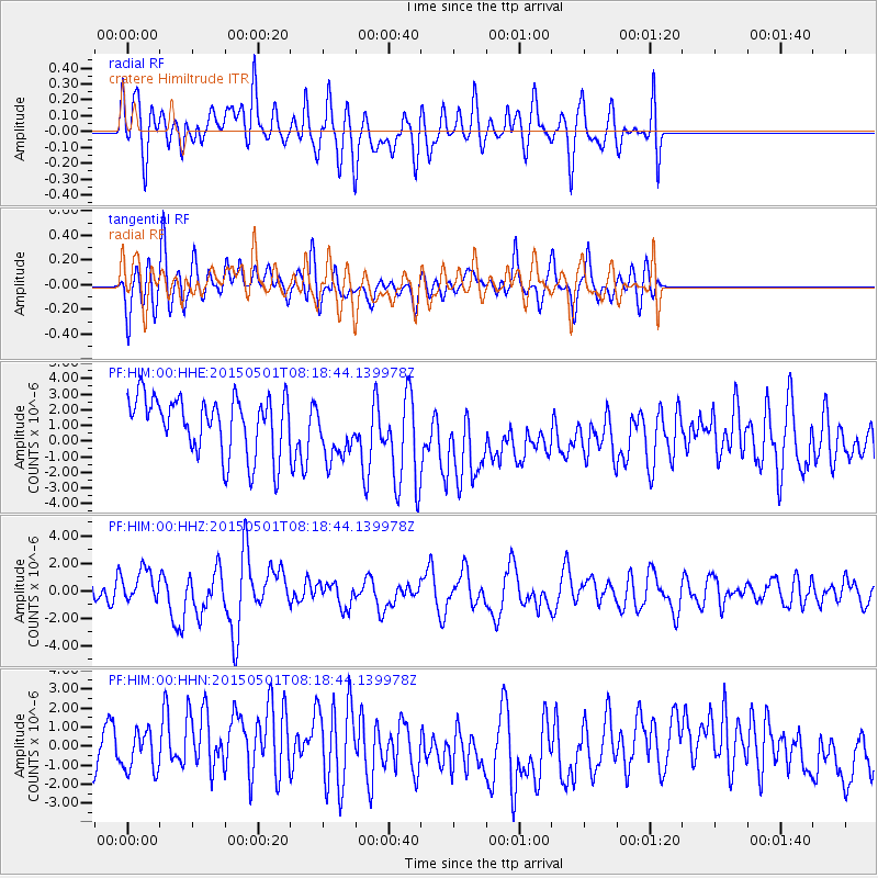
HIM cratere Himiltrude - Earthquake Result Viewer
*The percent match for this event was below the threshold and hence no stack was calculated.
| Earthquake location: |
New Britain Region, P.N.G. |
| Earthquake latitude/longitude: |
-5.2/151.8 |
| Earthquake time(UTC): |
2015/05/01 (121) 08:06:05 GMT |
| Earthquake Depth: |
54 km |
| Earthquake Magnitude: |
7.1 MO |
| Earthquake Catalog/Contributor: |
NEIC PDE/NEIC ALERT |
|
| Network: |
PF Volcanologic Network of Piton de Fournaise-OVPF |
| Station: |
HIM cratere Himiltrude |
| Lat/Lon: |
21.21 S/55.72 E |
| Elevation: |
1958 m |
|
| Distance: |
93.8 deg |
| Az: |
248.413 deg |
| Baz: |
97.026 deg |
| Ray Param: |
$rayparam |
*The percent match for this event was below the threshold and hence was not used in the summary stack. |
|
| Radial Match: |
37.199913 % |
| Radial Bump: |
400 |
| Transverse Match: |
54.600643 % |
| Transverse Bump: |
400 |
| SOD ConfigId: |
7422571 |
| Insert Time: |
2019-04-18 15:00:42.428 +0000 |
| GWidth: |
2.5 |
| Max Bumps: |
400 |
| Tol: |
0.001 |
|
Signal To Noise
| Channel | StoN | STA | LTA |
| PF:HIM:00:HHZ:20150501T08:18:44.139978Z | 1.4512662 | 1.1918175E-6 | 8.21226E-7 |
| PF:HIM:00:HHN:20150501T08:18:44.139978Z | 0.81939507 | 1.1732656E-6 | 1.4318681E-6 |
| PF:HIM:00:HHE:20150501T08:18:44.139978Z | 0.96339124 | 1.801939E-6 | 1.8704123E-6 |
| Arrivals |
| Ps | |
| PpPs | |
| PsPs/PpSs | |


