You are here: Home > Network List > TA - USArray Transportable Network (new EarthScope stations) Stations List
> Station J04D Umpqua National Forest, Toketee, OR, USA > Earthquake Result Viewer
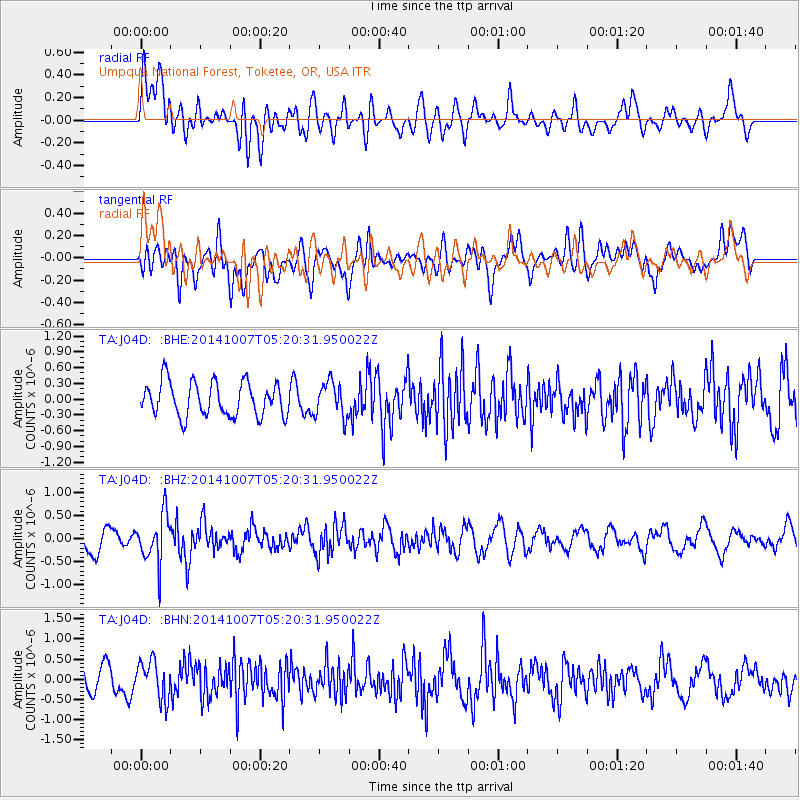
J04D Umpqua National Forest, Toketee, OR, USA - Earthquake Result Viewer
*The percent match for this event was below the threshold and hence no stack was calculated.
| Earthquake location: |
Northern Chile |
| Earthquake latitude/longitude: |
-19.7/-69.7 |
| Earthquake time(UTC): |
2014/10/07 (280) 05:09:10 GMT |
| Earthquake Depth: |
103 km |
| Earthquake Magnitude: |
5.8 MB |
| Earthquake Catalog/Contributor: |
NEIC PDE/NEIC COMCAT |
|
| Network: |
TA USArray Transportable Network (new EarthScope stations) |
| Station: |
J04D Umpqua National Forest, Toketee, OR, USA |
| Lat/Lon: |
43.24 N/122.11 W |
| Elevation: |
1948 m |
|
| Distance: |
79.0 deg |
| Az: |
323.819 deg |
| Baz: |
130.422 deg |
| Ray Param: |
$rayparam |
*The percent match for this event was below the threshold and hence was not used in the summary stack. |
|
| Radial Match: |
48.899555 % |
| Radial Bump: |
400 |
| Transverse Match: |
59.10385 % |
| Transverse Bump: |
400 |
| SOD ConfigId: |
796777 |
| Insert Time: |
2014-10-21 05:42:21.546 +0000 |
| GWidth: |
2.5 |
| Max Bumps: |
400 |
| Tol: |
0.001 |
|
Signal To Noise
| Channel | StoN | STA | LTA |
| TA:J04D: :BHZ:20141007T05:20:31.950022Z | 2.1301188 | 5.132377E-7 | 2.4094325E-7 |
| TA:J04D: :BHN:20141007T05:20:31.950022Z | 1.8254472 | 4.7124783E-7 | 2.5815473E-7 |
| TA:J04D: :BHE:20141007T05:20:31.950022Z | 1.0297041 | 3.3192228E-7 | 3.2234723E-7 |
| Arrivals |
| Ps | |
| PpPs | |
| PsPs/PpSs | |


