You are here: Home > Network List > TA - USArray Transportable Network (new EarthScope stations) Stations List
> Station W60A Pink Hill, NC, USA > Earthquake Result Viewer
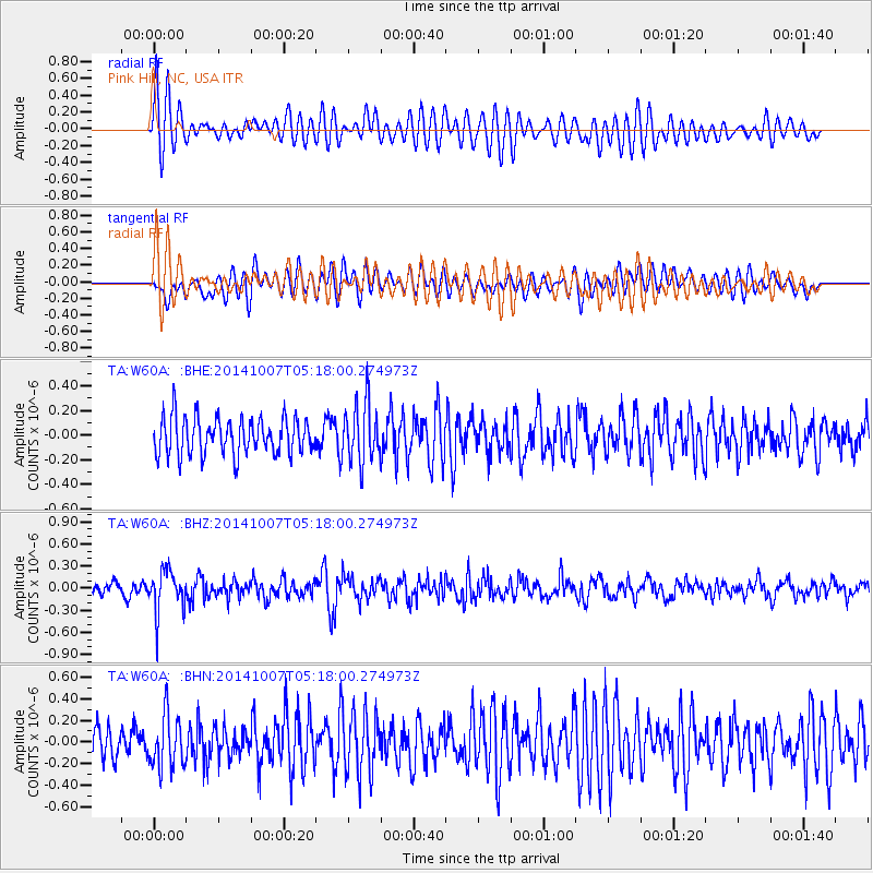
W60A Pink Hill, NC, USA - Earthquake Result Viewer
*The percent match for this event was below the threshold and hence no stack was calculated.
| Earthquake location: |
Northern Chile |
| Earthquake latitude/longitude: |
-19.7/-69.7 |
| Earthquake time(UTC): |
2014/10/07 (280) 05:09:10 GMT |
| Earthquake Depth: |
103 km |
| Earthquake Magnitude: |
5.8 MB |
| Earthquake Catalog/Contributor: |
NEIC PDE/NEIC COMCAT |
|
| Network: |
TA USArray Transportable Network (new EarthScope stations) |
| Station: |
W60A Pink Hill, NC, USA |
| Lat/Lon: |
35.05 N/77.71 W |
| Elevation: |
30 m |
|
| Distance: |
55.0 deg |
| Az: |
351.92 deg |
| Baz: |
170.709 deg |
| Ray Param: |
$rayparam |
*The percent match for this event was below the threshold and hence was not used in the summary stack. |
|
| Radial Match: |
71.1207 % |
| Radial Bump: |
400 |
| Transverse Match: |
61.275433 % |
| Transverse Bump: |
400 |
| SOD ConfigId: |
796777 |
| Insert Time: |
2014-10-21 05:47:24.417 +0000 |
| GWidth: |
2.5 |
| Max Bumps: |
400 |
| Tol: |
0.001 |
|
Signal To Noise
| Channel | StoN | STA | LTA |
| TA:W60A: :BHZ:20141007T05:18:00.274973Z | 2.784614 | 2.8353634E-7 | 1.01822486E-7 |
| TA:W60A: :BHN:20141007T05:18:00.274973Z | 1.4387659 | 2.4660466E-7 | 1.7140012E-7 |
| TA:W60A: :BHE:20141007T05:18:00.274973Z | 1.6392182 | 2.434578E-7 | 1.4852068E-7 |
| Arrivals |
| Ps | |
| PpPs | |
| PsPs/PpSs | |


