You are here: Home > Network List > TA - USArray Transportable Network (new EarthScope stations) Stations List
> Station Z41A Richland Creek Farm, El Dorado, AR, USA > Earthquake Result Viewer
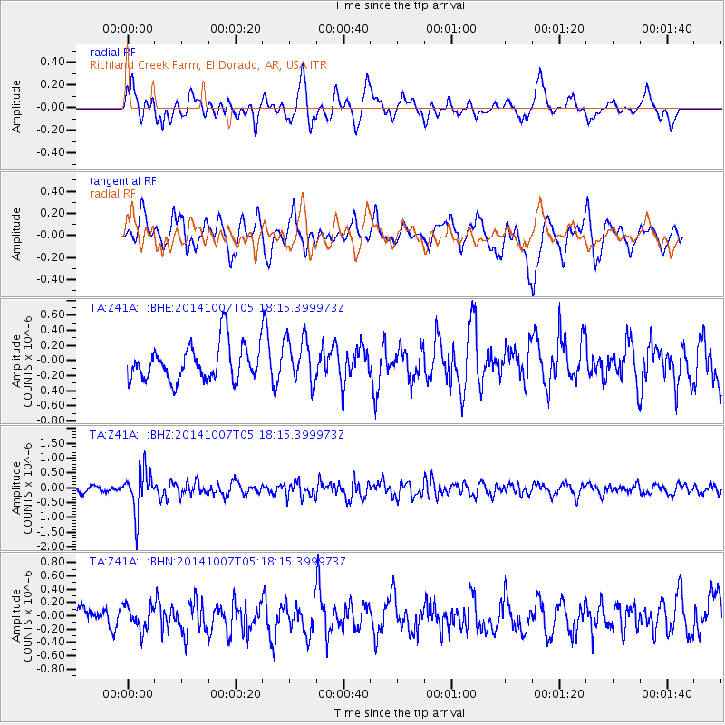
Z41A Richland Creek Farm, El Dorado, AR, USA - Earthquake Result Viewer
*The percent match for this event was below the threshold and hence no stack was calculated.
| Earthquake location: |
Northern Chile |
| Earthquake latitude/longitude: |
-19.7/-69.7 |
| Earthquake time(UTC): |
2014/10/07 (280) 05:09:10 GMT |
| Earthquake Depth: |
103 km |
| Earthquake Magnitude: |
5.8 MB |
| Earthquake Catalog/Contributor: |
NEIC PDE/NEIC COMCAT |
|
| Network: |
TA USArray Transportable Network (new EarthScope stations) |
| Station: |
Z41A Richland Creek Farm, El Dorado, AR, USA |
| Lat/Lon: |
33.26 N/92.80 W |
| Elevation: |
62 m |
|
| Distance: |
57.1 deg |
| Az: |
336.893 deg |
| Baz: |
153.807 deg |
| Ray Param: |
$rayparam |
*The percent match for this event was below the threshold and hence was not used in the summary stack. |
|
| Radial Match: |
58.16328 % |
| Radial Bump: |
400 |
| Transverse Match: |
65.77476 % |
| Transverse Bump: |
400 |
| SOD ConfigId: |
796777 |
| Insert Time: |
2014-10-21 05:47:59.441 +0000 |
| GWidth: |
2.5 |
| Max Bumps: |
400 |
| Tol: |
0.001 |
|
Signal To Noise
| Channel | StoN | STA | LTA |
| TA:Z41A: :BHZ:20141007T05:18:15.399973Z | 5.9336762 | 7.067599E-7 | 1.19109956E-7 |
| TA:Z41A: :BHN:20141007T05:18:15.399973Z | 1.2218944 | 1.8401737E-7 | 1.5060006E-7 |
| TA:Z41A: :BHE:20141007T05:18:15.399973Z | 1.240752 | 2.9801197E-7 | 2.4018658E-7 |
| Arrivals |
| Ps | |
| PpPs | |
| PsPs/PpSs | |


