You are here: Home > Network List > UW - Pacific Northwest Regional Seismic Network Stations List
> Station HOOD Mt Hood Meadows, OR CREST BB SMO > Earthquake Result Viewer
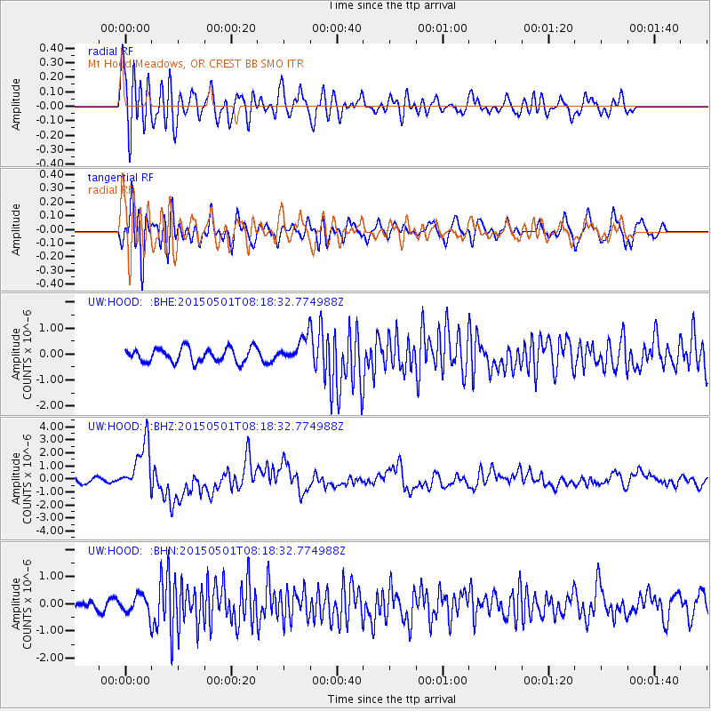
HOOD Mt Hood Meadows, OR CREST BB SMO - Earthquake Result Viewer
*The percent match for this event was below the threshold and hence no stack was calculated.
| Earthquake location: |
New Britain Region, P.N.G. |
| Earthquake latitude/longitude: |
-5.2/151.8 |
| Earthquake time(UTC): |
2015/05/01 (121) 08:06:05 GMT |
| Earthquake Depth: |
54 km |
| Earthquake Magnitude: |
7.1 MO |
| Earthquake Catalog/Contributor: |
NEIC PDE/NEIC ALERT |
|
| Network: |
UW Pacific Northwest Regional Seismic Network |
| Station: |
HOOD Mt Hood Meadows, OR CREST BB SMO |
| Lat/Lon: |
45.32 N/121.65 W |
| Elevation: |
1520 m |
|
| Distance: |
91.3 deg |
| Az: |
44.783 deg |
| Baz: |
263.918 deg |
| Ray Param: |
$rayparam |
*The percent match for this event was below the threshold and hence was not used in the summary stack. |
|
| Radial Match: |
77.51212 % |
| Radial Bump: |
400 |
| Transverse Match: |
73.21572 % |
| Transverse Bump: |
400 |
| SOD ConfigId: |
7422571 |
| Insert Time: |
2019-04-18 15:02:39.539 +0000 |
| GWidth: |
2.5 |
| Max Bumps: |
400 |
| Tol: |
0.001 |
|
Signal To Noise
| Channel | StoN | STA | LTA |
| UW:HOOD: :BHZ:20150501T08:18:32.774988Z | 11.300075 | 1.913676E-6 | 1.6935074E-7 |
| UW:HOOD: :BHN:20150501T08:18:32.774988Z | 1.7653749 | 3.4017526E-7 | 1.9269294E-7 |
| UW:HOOD: :BHE:20150501T08:18:32.774988Z | 2.1442487 | 5.874607E-7 | 2.739704E-7 |
| Arrivals |
| Ps | |
| PpPs | |
| PsPs/PpSs | |


