You are here: Home > Network List > UW - Pacific Northwest Regional Seismic Network Stations List
> Station LEBA Lebam, WA, USA > Earthquake Result Viewer
LEBA Lebam, WA, USA - Earthquake Result Viewer
*The percent match for this event was below the threshold and hence no stack was calculated.
| Earthquake location: |
New Britain Region, P.N.G. |
| Earthquake latitude/longitude: |
-5.2/151.8 |
| Earthquake time(UTC): |
2015/05/01 (121) 08:06:05 GMT |
| Earthquake Depth: |
54 km |
| Earthquake Magnitude: |
7.1 MO |
| Earthquake Catalog/Contributor: |
NEIC PDE/NEIC ALERT |
|
| Network: |
UW Pacific Northwest Regional Seismic Network |
| Station: |
LEBA Lebam, WA, USA |
| Lat/Lon: |
46.55 N/123.56 W |
| Elevation: |
73 m |
|
| Distance: |
90.1 deg |
| Az: |
43.41 deg |
| Baz: |
262.566 deg |
| Ray Param: |
$rayparam |
*The percent match for this event was below the threshold and hence was not used in the summary stack. |
|
| Radial Match: |
72.76024 % |
| Radial Bump: |
400 |
| Transverse Match: |
68.29405 % |
| Transverse Bump: |
400 |
| SOD ConfigId: |
7422571 |
| Insert Time: |
2019-04-18 15:02:43.143 +0000 |
| GWidth: |
2.5 |
| Max Bumps: |
400 |
| Tol: |
0.001 |
|
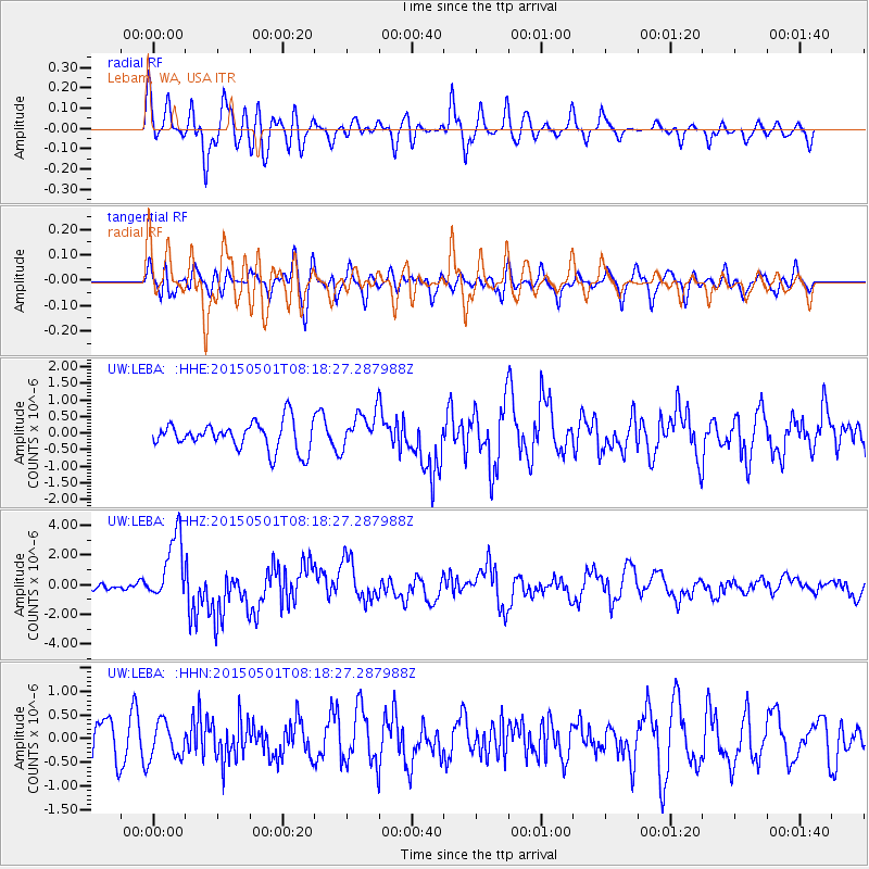
Signal To Noise
| Channel | StoN | STA | LTA |
| UW:LEBA: :HHZ:20150501T08:18:27.287988Z | 9.519168 | 2.2381612E-6 | 2.3512152E-7 |
| UW:LEBA: :HHN:20150501T08:18:27.287988Z | 1.1688606 | 3.880415E-7 | 3.3198276E-7 |
| UW:LEBA: :HHE:20150501T08:18:27.287988Z | 1.428765 | 6.151112E-7 | 4.3051952E-7 |
| Arrivals |
| Ps | |
| PpPs | |
| PsPs/PpSs | |


