You are here: Home > Network List > US - United States National Seismic Network Stations List
> Station HAWA Hanford, Washington, USA > Earthquake Result Viewer
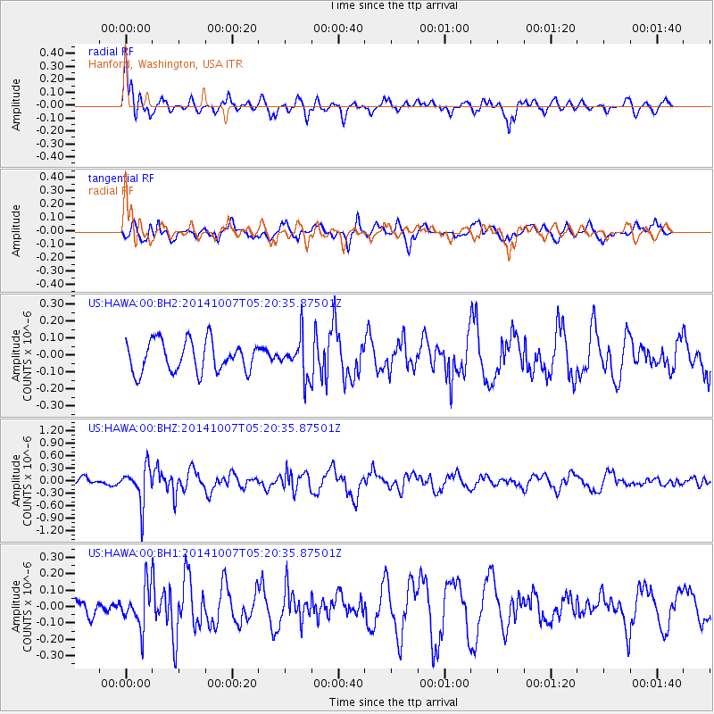
HAWA Hanford, Washington, USA - Earthquake Result Viewer
*The percent match for this event was below the threshold and hence no stack was calculated.
| Earthquake location: |
Northern Chile |
| Earthquake latitude/longitude: |
-19.7/-69.7 |
| Earthquake time(UTC): |
2014/10/07 (280) 05:09:10 GMT |
| Earthquake Depth: |
103 km |
| Earthquake Magnitude: |
5.8 MB |
| Earthquake Catalog/Contributor: |
NEIC PDE/NEIC COMCAT |
|
| Network: |
US United States National Seismic Network |
| Station: |
HAWA Hanford, Washington, USA |
| Lat/Lon: |
46.39 N/119.53 W |
| Elevation: |
364 m |
|
| Distance: |
79.7 deg |
| Az: |
327.455 deg |
| Baz: |
132.906 deg |
| Ray Param: |
$rayparam |
*The percent match for this event was below the threshold and hence was not used in the summary stack. |
|
| Radial Match: |
61.678925 % |
| Radial Bump: |
400 |
| Transverse Match: |
69.17096 % |
| Transverse Bump: |
400 |
| SOD ConfigId: |
796777 |
| Insert Time: |
2014-10-21 05:49:16.137 +0000 |
| GWidth: |
2.5 |
| Max Bumps: |
400 |
| Tol: |
0.001 |
|
Signal To Noise
| Channel | StoN | STA | LTA |
| US:HAWA:00:BHZ:20141007T05:20:35.87501Z | 2.3906982 | 4.3672466E-7 | 1.8267663E-7 |
| US:HAWA:00:BH1:20141007T05:20:35.87501Z | 1.1092738 | 1.247034E-7 | 1.1241896E-7 |
| US:HAWA:00:BH2:20141007T05:20:35.87501Z | 1.2690098 | 1.14699375E-7 | 9.038494E-8 |
| Arrivals |
| Ps | |
| PpPs | |
| PsPs/PpSs | |


