You are here: Home > Network List > CN - Canadian National Seismograph Network Stations List
> Station INK INUVIK, NT > Earthquake Result Viewer
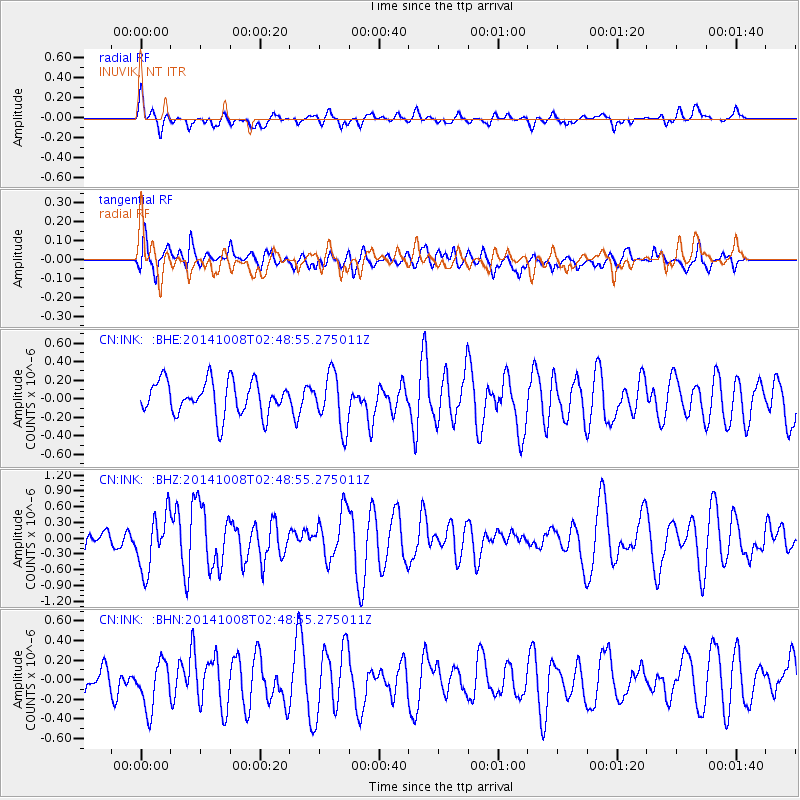
INK INUVIK, NT - Earthquake Result Viewer
*The percent match for this event was below the threshold and hence no stack was calculated.
| Earthquake location: |
Gulf Of California |
| Earthquake latitude/longitude: |
23.8/-108.4 |
| Earthquake time(UTC): |
2014/10/08 (281) 02:40:54 GMT |
| Earthquake Depth: |
10 km |
| Earthquake Magnitude: |
6.2 MWP |
| Earthquake Catalog/Contributor: |
NEIC PDE/NEIC COMCAT |
|
| Network: |
CN Canadian National Seismograph Network |
| Station: |
INK INUVIK, NT |
| Lat/Lon: |
68.31 N/133.53 W |
| Elevation: |
44 m |
|
| Distance: |
47.1 deg |
| Az: |
347.56 deg |
| Baz: |
147.951 deg |
| Ray Param: |
$rayparam |
*The percent match for this event was below the threshold and hence was not used in the summary stack. |
|
| Radial Match: |
48.013958 % |
| Radial Bump: |
400 |
| Transverse Match: |
52.66188 % |
| Transverse Bump: |
400 |
| SOD ConfigId: |
803114 |
| Insert Time: |
2014-10-22 03:00:52.180 +0000 |
| GWidth: |
2.5 |
| Max Bumps: |
400 |
| Tol: |
0.001 |
|
Signal To Noise
| Channel | StoN | STA | LTA |
| CN:INK: :BHZ:20141008T02:48:55.275011Z | 2.2153745 | 5.319077E-7 | 2.4009833E-7 |
| CN:INK: :BHN:20141008T02:48:55.275011Z | 1.0100938 | 2.3868768E-7 | 2.363025E-7 |
| CN:INK: :BHE:20141008T02:48:55.275011Z | 1.600637 | 2.91812E-7 | 1.8230992E-7 |
| Arrivals |
| Ps | |
| PpPs | |
| PsPs/PpSs | |


