You are here: Home > Network List > IU - Global Seismograph Network (GSN - IRIS/USGS) Stations List
> Station WVT Waverly, Tennessee, USA > Earthquake Result Viewer
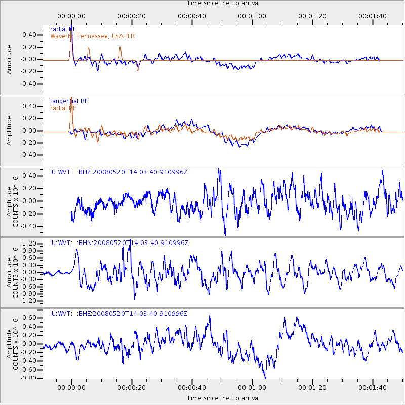
WVT Waverly, Tennessee, USA - Earthquake Result Viewer
*The percent match for this event was below the threshold and hence no stack was calculated.
| Earthquake location: |
Rat Islands, Aleutian Islands |
| Earthquake latitude/longitude: |
51.2/178.8 |
| Earthquake time(UTC): |
2008/05/20 (141) 13:53:35 GMT |
| Earthquake Depth: |
27 km |
| Earthquake Magnitude: |
5.8 MB, 6.0 MS, 6.3 MW, 6.3 MW |
| Earthquake Catalog/Contributor: |
WHDF/NEIC |
|
| Network: |
IU Global Seismograph Network (GSN - IRIS/USGS) |
| Station: |
WVT Waverly, Tennessee, USA |
| Lat/Lon: |
36.13 N/87.83 W |
| Elevation: |
157 m |
|
| Distance: |
64.8 deg |
| Az: |
63.265 deg |
| Baz: |
316.001 deg |
| Ray Param: |
$rayparam |
*The percent match for this event was below the threshold and hence was not used in the summary stack. |
|
| Radial Match: |
75.26974 % |
| Radial Bump: |
400 |
| Transverse Match: |
56.65919 % |
| Transverse Bump: |
400 |
| SOD ConfigId: |
2504 |
| Insert Time: |
2010-03-02 02:04:51.997 +0000 |
| GWidth: |
2.5 |
| Max Bumps: |
400 |
| Tol: |
0.001 |
|
Signal To Noise
| Channel | StoN | STA | LTA |
| IU:WVT: :BHN:20080520T14:03:40.910996Z | 5.2674837 | 4.4882577E-7 | 8.5206864E-8 |
| IU:WVT: :BHE:20080520T14:03:40.910996Z | 1.7118603 | 1.3854816E-7 | 8.0934264E-8 |
| IU:WVT: :BHZ:20080520T14:03:40.910996Z | 1.584195 | 1.5442635E-7 | 9.7479386E-8 |
| Arrivals |
| Ps | |
| PpPs | |
| PsPs/PpSs | |


