You are here: Home > Network List > TA - USArray Transportable Network (new EarthScope stations) Stations List
> Station G59A Clarenceville, QC, USA > Earthquake Result Viewer
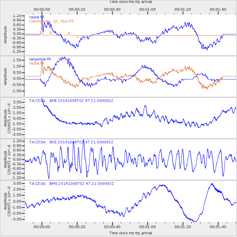
G59A Clarenceville, QC, USA - Earthquake Result Viewer
*The percent match for this event was below the threshold and hence no stack was calculated.
| Earthquake location: |
Gulf Of California |
| Earthquake latitude/longitude: |
23.8/-108.4 |
| Earthquake time(UTC): |
2014/10/08 (281) 02:40:54 GMT |
| Earthquake Depth: |
10 km |
| Earthquake Magnitude: |
6.2 MWP |
| Earthquake Catalog/Contributor: |
NEIC PDE/NEIC COMCAT |
|
| Network: |
TA USArray Transportable Network (new EarthScope stations) |
| Station: |
G59A Clarenceville, QC, USA |
| Lat/Lon: |
45.08 N/73.18 W |
| Elevation: |
36 m |
|
| Distance: |
35.6 deg |
| Az: |
44.641 deg |
| Baz: |
245.272 deg |
| Ray Param: |
$rayparam |
*The percent match for this event was below the threshold and hence was not used in the summary stack. |
|
| Radial Match: |
39.452885 % |
| Radial Bump: |
400 |
| Transverse Match: |
41.240456 % |
| Transverse Bump: |
400 |
| SOD ConfigId: |
803114 |
| Insert Time: |
2014-10-22 03:10:53.595 +0000 |
| GWidth: |
2.5 |
| Max Bumps: |
400 |
| Tol: |
0.001 |
|
Signal To Noise
| Channel | StoN | STA | LTA |
| TA:G59A: :BHZ:20141008T02:47:21.099993Z | 3.2558494 | 5.401906E-7 | 1.6591387E-7 |
| TA:G59A: :BHN:20141008T02:47:21.099993Z | 0.55213743 | 4.8786137E-7 | 8.835868E-7 |
| TA:G59A: :BHE:20141008T02:47:21.099993Z | 0.8439786 | 1.0649461E-6 | 1.2618165E-6 |
| Arrivals |
| Ps | |
| PpPs | |
| PsPs/PpSs | |


