You are here: Home > Network List > TA - USArray Transportable Network (new EarthScope stations) Stations List
> Station G65A Princeton, ME, USA > Earthquake Result Viewer
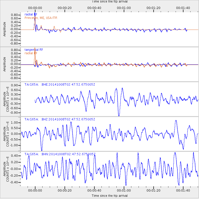
G65A Princeton, ME, USA - Earthquake Result Viewer
*The percent match for this event was below the threshold and hence no stack was calculated.
| Earthquake location: |
Gulf Of California |
| Earthquake latitude/longitude: |
23.8/-108.4 |
| Earthquake time(UTC): |
2014/10/08 (281) 02:40:54 GMT |
| Earthquake Depth: |
10 km |
| Earthquake Magnitude: |
6.2 MWP |
| Earthquake Catalog/Contributor: |
NEIC PDE/NEIC COMCAT |
|
| Network: |
TA USArray Transportable Network (new EarthScope stations) |
| Station: |
G65A Princeton, ME, USA |
| Lat/Lon: |
45.20 N/67.56 W |
| Elevation: |
78 m |
|
| Distance: |
39.3 deg |
| Az: |
46.891 deg |
| Baz: |
251.03 deg |
| Ray Param: |
$rayparam |
*The percent match for this event was below the threshold and hence was not used in the summary stack. |
|
| Radial Match: |
79.28677 % |
| Radial Bump: |
400 |
| Transverse Match: |
60.02126 % |
| Transverse Bump: |
400 |
| SOD ConfigId: |
803114 |
| Insert Time: |
2014-10-22 03:11:06.923 +0000 |
| GWidth: |
2.5 |
| Max Bumps: |
400 |
| Tol: |
0.001 |
|
Signal To Noise
| Channel | StoN | STA | LTA |
| TA:G65A: :BHZ:20141008T02:47:52.675005Z | 3.6222358 | 6.1152326E-7 | 1.688248E-7 |
| TA:G65A: :BHN:20141008T02:47:52.675005Z | 0.84631366 | 1.29741E-7 | 1.5330131E-7 |
| TA:G65A: :BHE:20141008T02:47:52.675005Z | 2.2271078 | 3.6195416E-7 | 1.6252208E-7 |
| Arrivals |
| Ps | |
| PpPs | |
| PsPs/PpSs | |


