You are here: Home > Network List > TA - USArray Transportable Network (new EarthScope stations) Stations List
> Station R59A King George, VA, USA > Earthquake Result Viewer
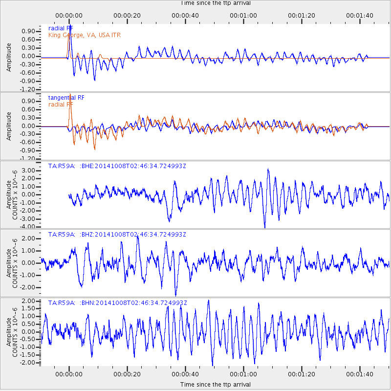
R59A King George, VA, USA - Earthquake Result Viewer
*The percent match for this event was below the threshold and hence no stack was calculated.
| Earthquake location: |
Gulf Of California |
| Earthquake latitude/longitude: |
23.8/-108.4 |
| Earthquake time(UTC): |
2014/10/08 (281) 02:40:54 GMT |
| Earthquake Depth: |
10 km |
| Earthquake Magnitude: |
6.2 MWP |
| Earthquake Catalog/Contributor: |
NEIC PDE/NEIC COMCAT |
|
| Network: |
TA USArray Transportable Network (new EarthScope stations) |
| Station: |
R59A King George, VA, USA |
| Lat/Lon: |
38.20 N/77.12 W |
| Elevation: |
35 m |
|
| Distance: |
30.3 deg |
| Az: |
54.343 deg |
| Baz: |
250.821 deg |
| Ray Param: |
$rayparam |
*The percent match for this event was below the threshold and hence was not used in the summary stack. |
|
| Radial Match: |
79.902695 % |
| Radial Bump: |
400 |
| Transverse Match: |
66.32238 % |
| Transverse Bump: |
400 |
| SOD ConfigId: |
803114 |
| Insert Time: |
2014-10-22 03:14:36.004 +0000 |
| GWidth: |
2.5 |
| Max Bumps: |
400 |
| Tol: |
0.001 |
|
Signal To Noise
| Channel | StoN | STA | LTA |
| TA:R59A: :BHZ:20141008T02:46:34.724993Z | 4.825334 | 1.0467631E-6 | 2.169307E-7 |
| TA:R59A: :BHN:20141008T02:46:34.724993Z | 1.1239033 | 4.1420014E-7 | 3.6853717E-7 |
| TA:R59A: :BHE:20141008T02:46:34.724993Z | 2.651131 | 1.3990827E-6 | 5.277305E-7 |
| Arrivals |
| Ps | |
| PpPs | |
| PsPs/PpSs | |


