
GRFO Grafenberg, Germany - Earthquake Result Viewer
| ||||||||||||||||||
| ||||||||||||||||||
| ||||||||||||||||||
|
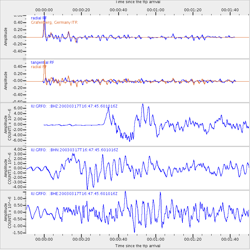
Signal To Noise
| Channel | StoN | STA | LTA |
| IU:GRFO: :BHN:20030317T16:47:45.601016Z | 4.775343 | 1.0265305E-6 | 2.1496479E-7 |
| IU:GRFO: :BHE:20030317T16:47:45.601016Z | 0.49861026 | 1.501159E-7 | 3.010686E-7 |
| IU:GRFO: :BHZ:20030317T16:47:45.601016Z | 26.649288 | 2.7673707E-6 | 1.0384407E-7 |
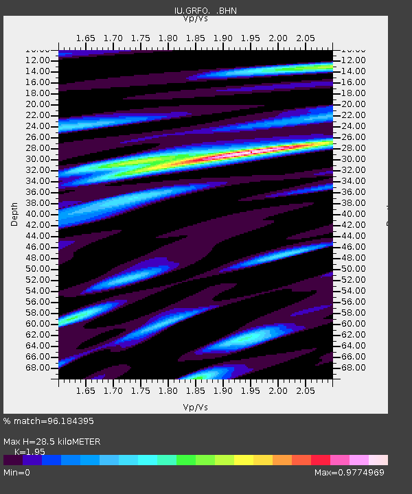
| Arrivals | |
| Ps | 4.5 SECOND |
| PpPs | 13 SECOND |
| PsPs/PpSs | 18 SECOND |

