
GRFO Grafenberg, Germany - Earthquake Result Viewer
| ||||||||||||||||||
| ||||||||||||||||||
| ||||||||||||||||||
|
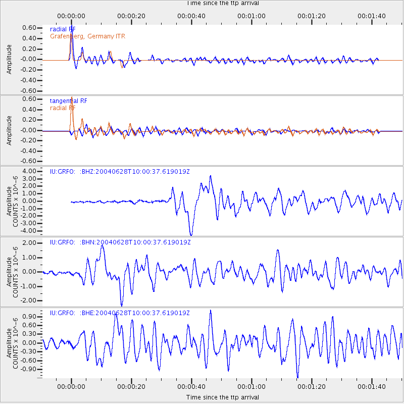
Signal To Noise
| Channel | StoN | STA | LTA |
| IU:GRFO: :BHN:20040628T10:00:37.619019Z | 3.3667848 | 3.129173E-7 | 9.294248E-8 |
| IU:GRFO: :BHE:20040628T10:00:37.619019Z | 2.5398183 | 2.1042518E-7 | 8.285049E-8 |
| IU:GRFO: :BHZ:20040628T10:00:37.619019Z | 6.837915 | 6.5066337E-7 | 9.515522E-8 |
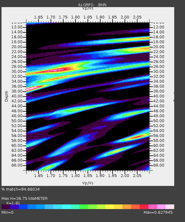
| Arrivals | |
| Ps | 3.8 SECOND |
| PpPs | 15 SECOND |
| PsPs/PpSs | 19 SECOND |

