
GRFO Grafenberg, Germany - Earthquake Result Viewer
| ||||||||||||||||||
| ||||||||||||||||||
| ||||||||||||||||||
|
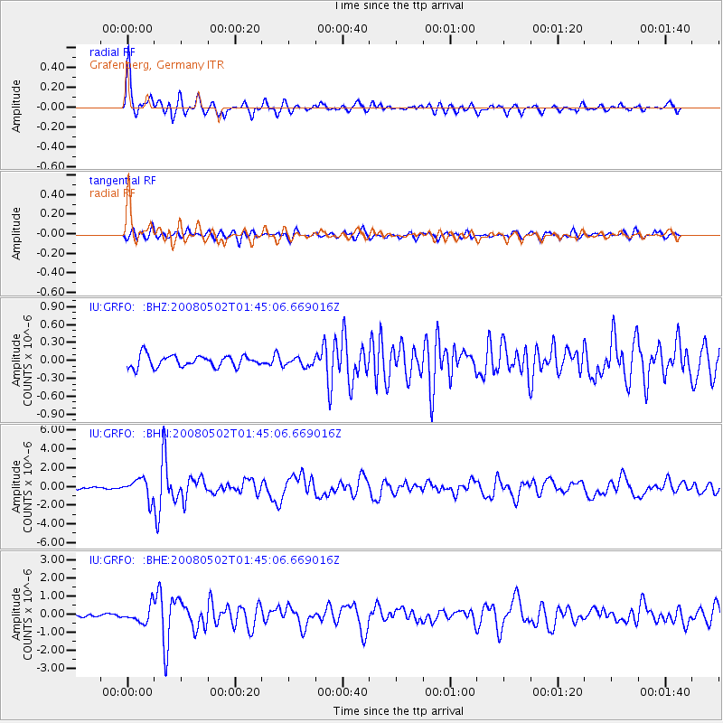
Signal To Noise
| Channel | StoN | STA | LTA |
| IU:GRFO: :BHN:20080502T01:45:06.669016Z | 13.074439 | 1.0798187E-6 | 8.2590056E-8 |
| IU:GRFO: :BHE:20080502T01:45:06.669016Z | 3.9897008 | 4.6886197E-7 | 1.1751807E-7 |
| IU:GRFO: :BHZ:20080502T01:45:06.669016Z | 0.7050042 | 6.961181E-8 | 9.873956E-8 |
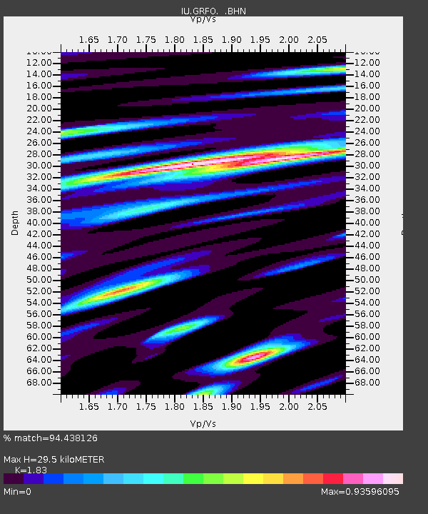
| Arrivals | |
| Ps | 4.1 SECOND |
| PpPs | 13 SECOND |
| PsPs/PpSs | 17 SECOND |

