GRFO Grafenberg, Germany - Earthquake Result Viewer
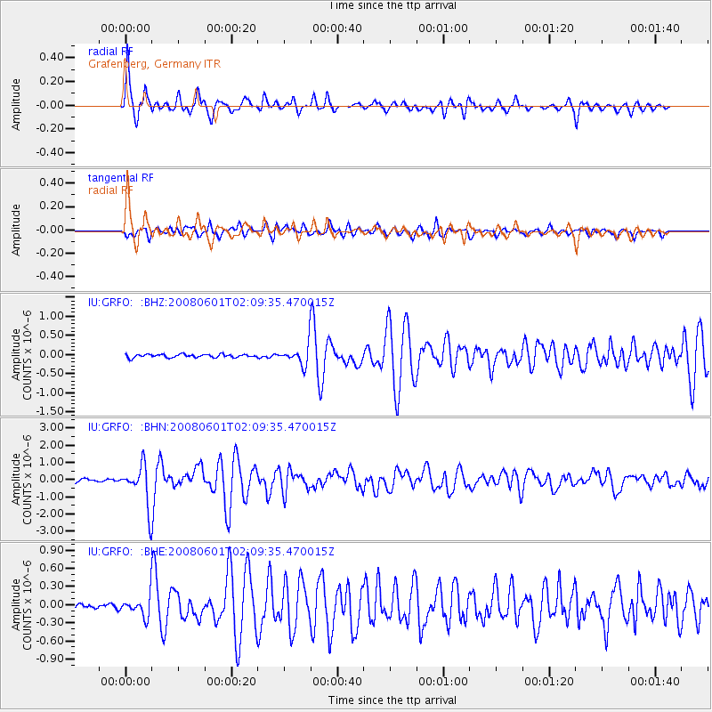
Earthquake location: Philippine Islands Region
Earthquake latitude/longitude: 20.1/121.4
Earthquake time(UTC): 2008/06/01 (153) 01:57:24 GMT
Earthquake Depth: 35 km
Earthquake Magnitude: 6.0 MB, 6.2 MS, 6.3 MW, 6.2 MW
Earthquake Catalog/Contributor: WHDF/NEIC
Network: IU Global Seismograph Network (GSN - IRIS/USGS)
Station: GRFO Grafenberg, Germany
Lat/Lon: 49.69 N/11.22 E
Elevation: 384 m
Distance: 87.1 deg
Az: 322.378 deg
Baz: 62.039 deg
Ray Param: 0.04349206
Estimated Moho Depth: 10.75 km
Estimated Crust Vp/Vs: 1.60
Assumed Crust Vp: 6.182 km/s
Estimated Crust Vs: 3.864 km/s
Estimated Crust Poisson's Ratio: 0.18
Radial Match: 94.2134 %
Radial Bump: 339
Transverse Match: 87.541534 %
Transverse Bump: 400
SOD ConfigId: 2504
Insert Time: 2010-03-02 02:11:14.216 +0000
GWidth: 2.5
Max Bumps: 400
Tol: 0.001

Signal To Noise

ChannelStoNSTALTA
IU:GRFO: :BHN:20080601T02:09:35.470015Z11.8058291.2087505E-61.02385904E-7
IU:GRFO: :BHE:20080601T02:09:35.470015Z4.15826561.6405734E-73.9453308E-8
IU:GRFO: :BHZ:20080601T02:09:35.470015Z6.18064262.538848E-74.1077413E-8
Arrivals
Ps1.1 SECOND
PpPs4.4 SECOND
PsPs/PpSs5.5 SECOND