GRFO Grafenberg, Germany - Earthquake Result Viewer
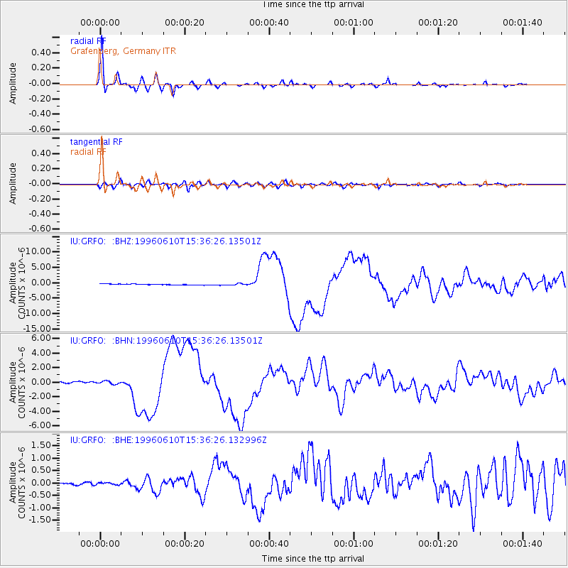
Earthquake location: Andreanof Islands, Aleutian Is.
Earthquake latitude/longitude: 51.5/-176.8
Earthquake time(UTC): 1996/06/10 (162) 15:24:56 GMT
Earthquake Depth: 26 km
Earthquake Magnitude: 5.9 MB, 7.1 MS, 7.2 UNKNOWN, 6.9 MS
Earthquake Catalog/Contributor: WHDF/NEIC
Network: IU Global Seismograph Network (GSN - IRIS/USGS)
Station: GRFO Grafenberg, Germany
Lat/Lon: 49.69 N/11.22 E
Elevation: 425 m
Distance: 79.0 deg
Az: 354.671 deg
Baz: 5.131 deg
Ray Param: 0.049248345
Estimated Moho Depth: 29.5 km
Estimated Crust Vp/Vs: 1.85
Assumed Crust Vp: 6.182 km/s
Estimated Crust Vs: 3.337 km/s
Estimated Crust Poisson's Ratio: 0.29
Radial Match: 98.91193 %
Radial Bump: 307
Transverse Match: 91.57434 %
Transverse Bump: 400
SOD ConfigId: 6273
Insert Time: 2010-03-02 02:15:10.170 +0000
GWidth: 2.5
Max Bumps: 400
Tol: 0.001

Signal To Noise

ChannelStoNSTALTA
IU:GRFO: :BHN:19960610T15:36:26.13501Z1.61423582.0461466E-71.2675636E-7
IU:GRFO: :BHE:19960610T15:36:26.132996Z0.480480644.0610587E-88.452076E-8
IU:GRFO: :BHZ:19960610T15:36:26.13501Z1.53746312.2033845E-71.43313E-7
Arrivals
Ps4.2 SECOND
PpPs13 SECOND
PsPs/PpSs17 SECOND