You are here: Home > Network List > NM - Cooperative New Madrid Seismic Network Stations List
> Station HDAR2 I40 Weigh Station,West Memphis,AR > Earthquake Result Viewer
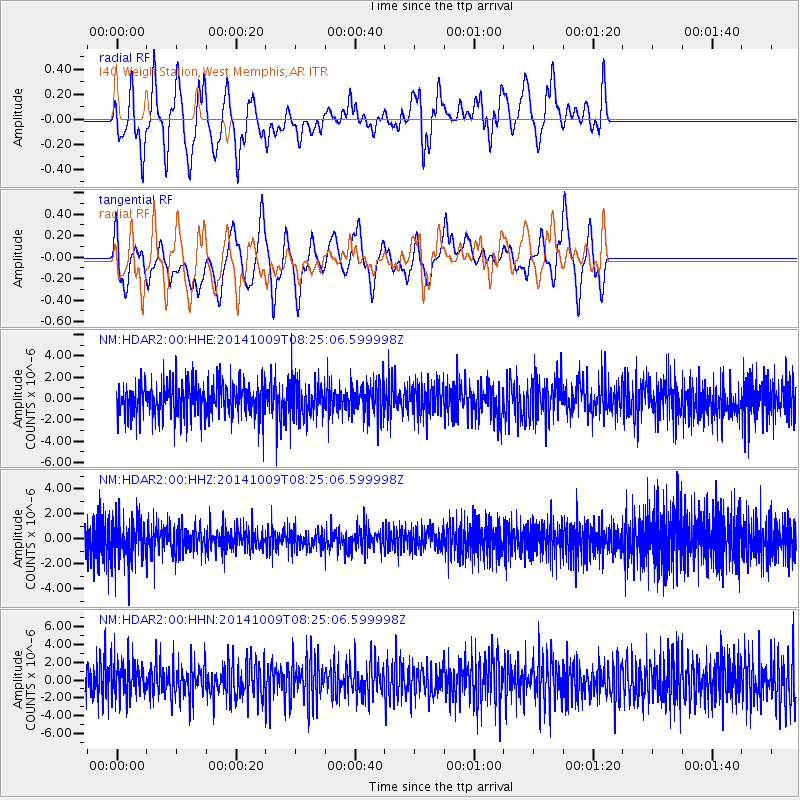
HDAR2 I40 Weigh Station,West Memphis,AR - Earthquake Result Viewer
*The percent match for this event was below the threshold and hence no stack was calculated.
| Earthquake location: |
Southern East Pacific Rise |
| Earthquake latitude/longitude: |
-32.7/-111.6 |
| Earthquake time(UTC): |
2014/10/09 (282) 08:14:23 GMT |
| Earthquake Depth: |
10 km |
| Earthquake Magnitude: |
5.6 MB |
| Earthquake Catalog/Contributor: |
NEIC PDE/NEIC COMCAT |
|
| Network: |
NM Cooperative New Madrid Seismic Network |
| Station: |
HDAR2 I40 Weigh Station,West Memphis,AR |
| Lat/Lon: |
35.15 N/90.09 W |
| Elevation: |
100 m |
|
| Distance: |
70.4 deg |
| Az: |
18.621 deg |
| Baz: |
199.189 deg |
| Ray Param: |
$rayparam |
*The percent match for this event was below the threshold and hence was not used in the summary stack. |
|
| Radial Match: |
63.656673 % |
| Radial Bump: |
400 |
| Transverse Match: |
39.654324 % |
| Transverse Bump: |
400 |
| SOD ConfigId: |
803114 |
| Insert Time: |
2014-10-23 08:35:37.192 +0000 |
| GWidth: |
2.5 |
| Max Bumps: |
400 |
| Tol: |
0.001 |
|
Signal To Noise
| Channel | StoN | STA | LTA |
| NM:HDAR2:00:HHZ:20141009T08:25:06.599998Z | 1.2010838 | 1.5821727E-6 | 1.3172875E-6 |
| NM:HDAR2:00:HHN:20141009T08:25:06.599998Z | 1.1082126 | 1.9755114E-6 | 1.7826104E-6 |
| NM:HDAR2:00:HHE:20141009T08:25:06.599998Z | 1.125503 | 1.7677418E-6 | 1.5706239E-6 |
| Arrivals |
| Ps | |
| PpPs | |
| PsPs/PpSs | |


