You are here: Home > Network List > IU - Global Seismograph Network (GSN - IRIS/USGS) Stations List
> Station PMG Port Moresby, New Guinea > Earthquake Result Viewer
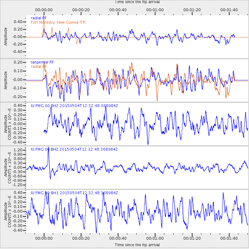
PMG Port Moresby, New Guinea - Earthquake Result Viewer
*The percent match for this event was below the threshold and hence no stack was calculated.
| Earthquake location: |
Balleny Islands Region |
| Earthquake latitude/longitude: |
-61.4/154.5 |
| Earthquake time(UTC): |
2015/05/04 (124) 12:24:09 GMT |
| Earthquake Depth: |
14 km |
| Earthquake Magnitude: |
5.7 MW |
| Earthquake Catalog/Contributor: |
ISC/ISC |
|
| Network: |
IU Global Seismograph Network (GSN - IRIS/USGS) |
| Station: |
PMG Port Moresby, New Guinea |
| Lat/Lon: |
9.40 S/147.16 E |
| Elevation: |
90 m |
|
| Distance: |
52.2 deg |
| Az: |
350.813 deg |
| Baz: |
175.536 deg |
| Ray Param: |
$rayparam |
*The percent match for this event was below the threshold and hence was not used in the summary stack. |
|
| Radial Match: |
55.799213 % |
| Radial Bump: |
400 |
| Transverse Match: |
47.91244 % |
| Transverse Bump: |
400 |
| SOD ConfigId: |
7422571 |
| Insert Time: |
2019-04-18 15:56:15.191 +0000 |
| GWidth: |
2.5 |
| Max Bumps: |
400 |
| Tol: |
0.001 |
|
Signal To Noise
| Channel | StoN | STA | LTA |
| IU:PMG:00:BHZ:20150504T12:32:48.368984Z | 3.5950692 | 4.6528658E-7 | 1.2942354E-7 |
| IU:PMG:00:BH1:20150504T12:32:48.368984Z | 1.6258379 | 2.2343278E-7 | 1.3742623E-7 |
| IU:PMG:00:BH2:20150504T12:32:48.368984Z | 1.0077649 | 1.3487518E-7 | 1.3383594E-7 |
| Arrivals |
| Ps | |
| PpPs | |
| PsPs/PpSs | |


