You are here: Home > Network List > TA - USArray Transportable Network (new EarthScope stations) Stations List
> Station P56A Dayton Farm, Ripley, WV, USA > Earthquake Result Viewer
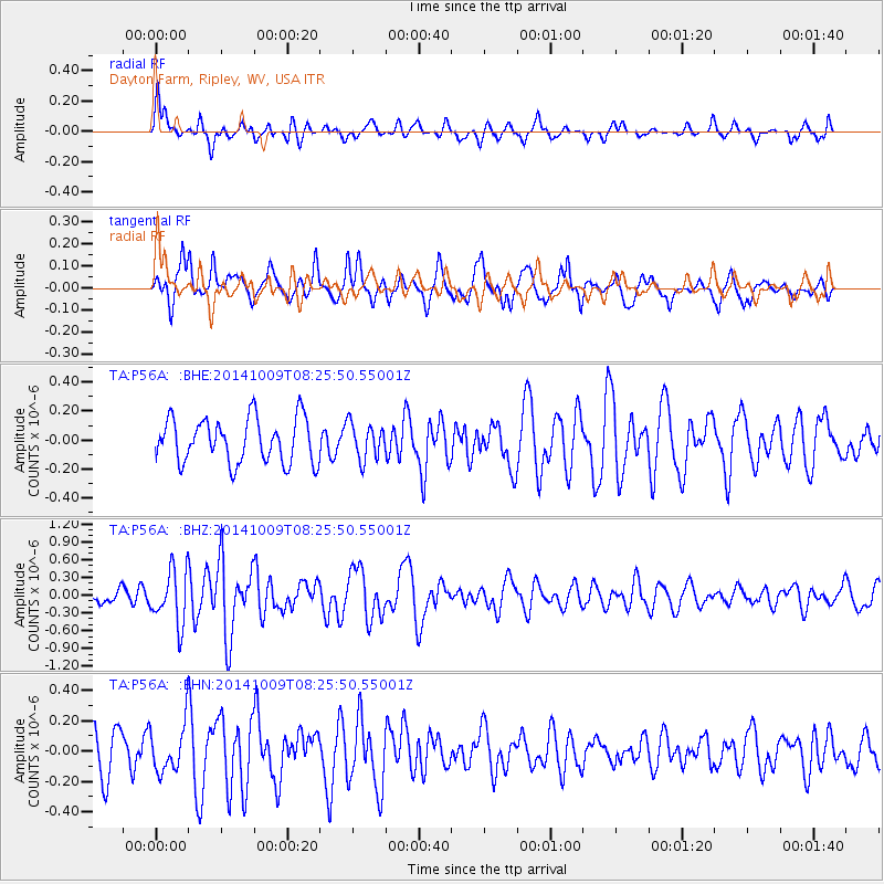
P56A Dayton Farm, Ripley, WV, USA - Earthquake Result Viewer
*The percent match for this event was below the threshold and hence no stack was calculated.
| Earthquake location: |
Southern East Pacific Rise |
| Earthquake latitude/longitude: |
-32.7/-111.6 |
| Earthquake time(UTC): |
2014/10/09 (282) 08:14:23 GMT |
| Earthquake Depth: |
10 km |
| Earthquake Magnitude: |
5.6 MB |
| Earthquake Catalog/Contributor: |
NEIC PDE/NEIC COMCAT |
|
| Network: |
TA USArray Transportable Network (new EarthScope stations) |
| Station: |
P56A Dayton Farm, Ripley, WV, USA |
| Lat/Lon: |
39.50 N/78.84 W |
| Elevation: |
249 m |
|
| Distance: |
78.0 deg |
| Az: |
25.367 deg |
| Baz: |
207.844 deg |
| Ray Param: |
$rayparam |
*The percent match for this event was below the threshold and hence was not used in the summary stack. |
|
| Radial Match: |
60.564907 % |
| Radial Bump: |
400 |
| Transverse Match: |
57.22414 % |
| Transverse Bump: |
400 |
| SOD ConfigId: |
803114 |
| Insert Time: |
2014-10-23 08:45:22.784 +0000 |
| GWidth: |
2.5 |
| Max Bumps: |
400 |
| Tol: |
0.001 |
|
Signal To Noise
| Channel | StoN | STA | LTA |
| TA:P56A: :BHZ:20141009T08:25:50.55001Z | 2.9339888 | 4.5390104E-7 | 1.5470442E-7 |
| TA:P56A: :BHN:20141009T08:25:50.55001Z | 1.2817258 | 1.5648078E-7 | 1.22086E-7 |
| TA:P56A: :BHE:20141009T08:25:50.55001Z | 0.80575216 | 1.2314999E-7 | 1.5283855E-7 |
| Arrivals |
| Ps | |
| PpPs | |
| PsPs/PpSs | |


