You are here: Home > Network List > TA - USArray Transportable Network (new EarthScope stations) Stations List
> Station Q56A Snyder Ridge, Maysville, WV, USA > Earthquake Result Viewer
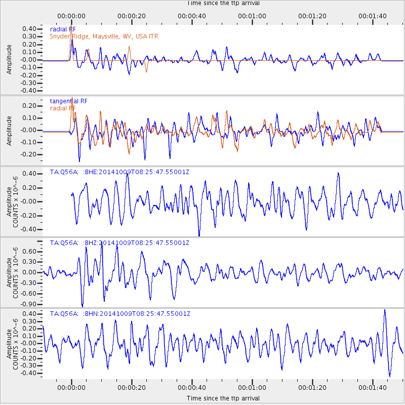
Q56A Snyder Ridge, Maysville, WV, USA - Earthquake Result Viewer
*The percent match for this event was below the threshold and hence no stack was calculated.
| Earthquake location: |
Southern East Pacific Rise |
| Earthquake latitude/longitude: |
-32.7/-111.6 |
| Earthquake time(UTC): |
2014/10/09 (282) 08:14:23 GMT |
| Earthquake Depth: |
10 km |
| Earthquake Magnitude: |
5.6 MB |
| Earthquake Catalog/Contributor: |
NEIC PDE/NEIC COMCAT |
|
| Network: |
TA USArray Transportable Network (new EarthScope stations) |
| Station: |
Q56A Snyder Ridge, Maysville, WV, USA |
| Lat/Lon: |
39.04 N/79.19 W |
| Elevation: |
430 m |
|
| Distance: |
77.4 deg |
| Az: |
25.342 deg |
| Baz: |
207.619 deg |
| Ray Param: |
$rayparam |
*The percent match for this event was below the threshold and hence was not used in the summary stack. |
|
| Radial Match: |
63.130245 % |
| Radial Bump: |
400 |
| Transverse Match: |
57.160328 % |
| Transverse Bump: |
400 |
| SOD ConfigId: |
803114 |
| Insert Time: |
2014-10-23 08:45:44.561 +0000 |
| GWidth: |
2.5 |
| Max Bumps: |
400 |
| Tol: |
0.001 |
|
Signal To Noise
| Channel | StoN | STA | LTA |
| TA:Q56A: :BHZ:20141009T08:25:47.55001Z | 2.5711877 | 3.786074E-7 | 1.4725E-7 |
| TA:Q56A: :BHN:20141009T08:25:47.55001Z | 1.2894601 | 1.3058758E-7 | 1.0127307E-7 |
| TA:Q56A: :BHE:20141009T08:25:47.55001Z | 0.6175038 | 1.06721366E-7 | 1.7282706E-7 |
| Arrivals |
| Ps | |
| PpPs | |
| PsPs/PpSs | |


