You are here: Home > Network List > TA - USArray Transportable Network (new EarthScope stations) Stations List
> Station S60A Water View, VA, USA > Earthquake Result Viewer
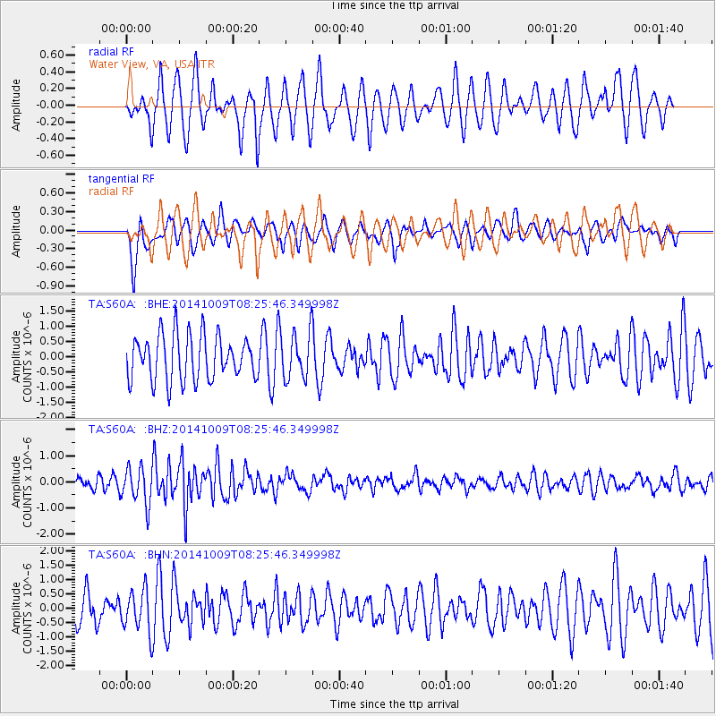
S60A Water View, VA, USA - Earthquake Result Viewer
*The percent match for this event was below the threshold and hence no stack was calculated.
| Earthquake location: |
Southern East Pacific Rise |
| Earthquake latitude/longitude: |
-32.7/-111.6 |
| Earthquake time(UTC): |
2014/10/09 (282) 08:14:23 GMT |
| Earthquake Depth: |
10 km |
| Earthquake Magnitude: |
5.6 MB |
| Earthquake Catalog/Contributor: |
NEIC PDE/NEIC COMCAT |
|
| Network: |
TA USArray Transportable Network (new EarthScope stations) |
| Station: |
S60A Water View, VA, USA |
| Lat/Lon: |
37.42 N/76.39 W |
| Elevation: |
36 m |
|
| Distance: |
77.1 deg |
| Az: |
28.117 deg |
| Baz: |
209.953 deg |
| Ray Param: |
$rayparam |
*The percent match for this event was below the threshold and hence was not used in the summary stack. |
|
| Radial Match: |
66.747765 % |
| Radial Bump: |
400 |
| Transverse Match: |
48.81646 % |
| Transverse Bump: |
400 |
| SOD ConfigId: |
803114 |
| Insert Time: |
2014-10-23 08:46:35.651 +0000 |
| GWidth: |
2.5 |
| Max Bumps: |
400 |
| Tol: |
0.001 |
|
Signal To Noise
| Channel | StoN | STA | LTA |
| TA:S60A: :BHZ:20141009T08:25:46.349998Z | 2.3483384 | 7.097543E-7 | 3.022368E-7 |
| TA:S60A: :BHN:20141009T08:25:46.349998Z | 1.4476458 | 7.588157E-7 | 5.241722E-7 |
| TA:S60A: :BHE:20141009T08:25:46.349998Z | 1.0401309 | 7.657428E-7 | 7.361985E-7 |
| Arrivals |
| Ps | |
| PpPs | |
| PsPs/PpSs | |


