GRFO Grafenberg, Germany - Earthquake Result Viewer
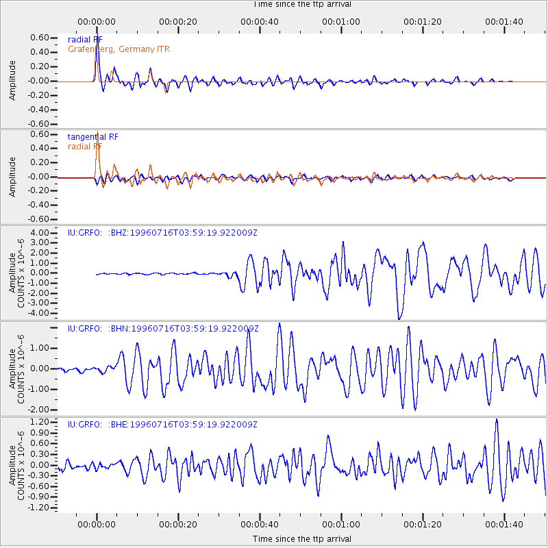
Earthquake location: Komandorskiye Ostrova Region
Earthquake latitude/longitude: 56.1/165.0
Earthquake time(UTC): 1996/07/16 (198) 03:48:28 GMT
Earthquake Depth: 33 km
Earthquake Magnitude: 5.8 MB, 6.4 MS, 6.5 UNKNOWN, 6.3 MW
Earthquake Catalog/Contributor: WHDF/NEIC
Network: IU Global Seismograph Network (GSN - IRIS/USGS)
Station: GRFO Grafenberg, Germany
Lat/Lon: 49.69 N/11.22 E
Elevation: 425 m
Distance: 72.4 deg
Az: 342.474 deg
Baz: 15.066 deg
Ray Param: 0.053667516
Estimated Moho Depth: 29.0 km
Estimated Crust Vp/Vs: 1.89
Assumed Crust Vp: 6.182 km/s
Estimated Crust Vs: 3.271 km/s
Estimated Crust Poisson's Ratio: 0.31
Radial Match: 94.52628 %
Radial Bump: 399
Transverse Match: 71.273315 %
Transverse Bump: 400
SOD ConfigId: 6273
Insert Time: 2010-03-02 02:16:07.023 +0000
GWidth: 2.5
Max Bumps: 400
Tol: 0.001

Signal To Noise

ChannelStoNSTALTA
IU:GRFO: :BHN:19960716T03:59:19.922009Z1.71135281.3148029E-77.682828E-8
IU:GRFO: :BHE:19960716T03:59:19.922009Z0.497099346.614503E-81.3306199E-7
IU:GRFO: :BHZ:19960716T03:59:19.922009Z3.47403812.165521E-76.23344E-8
Arrivals
Ps4.3 SECOND
PpPs13 SECOND
PsPs/PpSs17 SECOND