You are here: Home > Network List > TA - USArray Transportable Network (new EarthScope stations) Stations List
> Station T57A Hurt, VA, USA > Earthquake Result Viewer
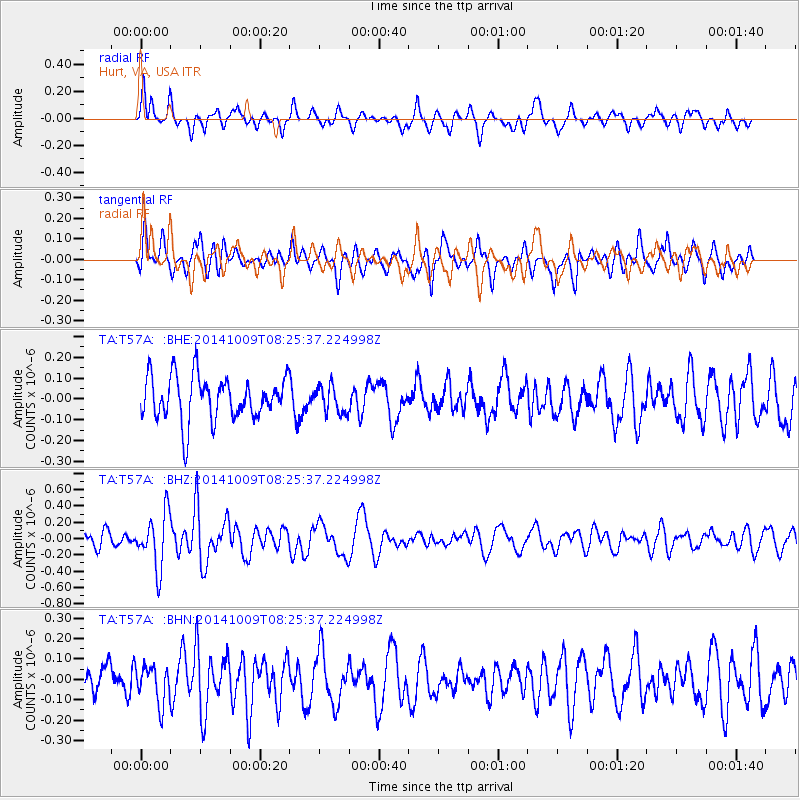
T57A Hurt, VA, USA - Earthquake Result Viewer
*The percent match for this event was below the threshold and hence no stack was calculated.
| Earthquake location: |
Southern East Pacific Rise |
| Earthquake latitude/longitude: |
-32.7/-111.6 |
| Earthquake time(UTC): |
2014/10/09 (282) 08:14:23 GMT |
| Earthquake Depth: |
10 km |
| Earthquake Magnitude: |
5.6 MB |
| Earthquake Catalog/Contributor: |
NEIC PDE/NEIC COMCAT |
|
| Network: |
TA USArray Transportable Network (new EarthScope stations) |
| Station: |
T57A Hurt, VA, USA |
| Lat/Lon: |
37.00 N/79.25 W |
| Elevation: |
230 m |
|
| Distance: |
75.6 deg |
| Az: |
26.269 deg |
| Baz: |
207.794 deg |
| Ray Param: |
$rayparam |
*The percent match for this event was below the threshold and hence was not used in the summary stack. |
|
| Radial Match: |
59.896122 % |
| Radial Bump: |
367 |
| Transverse Match: |
57.630806 % |
| Transverse Bump: |
400 |
| SOD ConfigId: |
803114 |
| Insert Time: |
2014-10-23 08:46:54.009 +0000 |
| GWidth: |
2.5 |
| Max Bumps: |
400 |
| Tol: |
0.001 |
|
Signal To Noise
| Channel | StoN | STA | LTA |
| TA:T57A: :BHZ:20141009T08:25:37.224998Z | 3.0669398 | 3.3201638E-7 | 1.08256565E-7 |
| TA:T57A: :BHN:20141009T08:25:37.224998Z | 0.73209506 | 9.187471E-8 | 1.2549559E-7 |
| TA:T57A: :BHE:20141009T08:25:37.224998Z | 0.62846196 | 6.600647E-8 | 1.050286E-7 |
| Arrivals |
| Ps | |
| PpPs | |
| PsPs/PpSs | |


