You are here: Home > Network List > TA - USArray Transportable Network (new EarthScope stations) Stations List
> Station V56A Mocksville, NC, USA > Earthquake Result Viewer
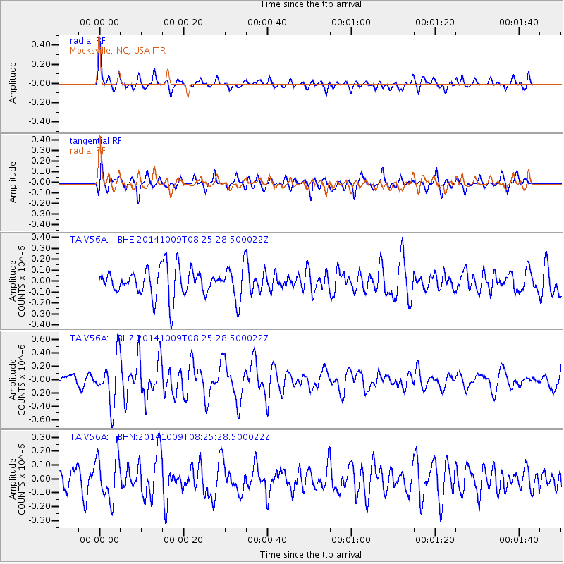
V56A Mocksville, NC, USA - Earthquake Result Viewer
*The percent match for this event was below the threshold and hence no stack was calculated.
| Earthquake location: |
Southern East Pacific Rise |
| Earthquake latitude/longitude: |
-32.7/-111.6 |
| Earthquake time(UTC): |
2014/10/09 (282) 08:14:23 GMT |
| Earthquake Depth: |
10 km |
| Earthquake Magnitude: |
5.6 MB |
| Earthquake Catalog/Contributor: |
NEIC PDE/NEIC COMCAT |
|
| Network: |
TA USArray Transportable Network (new EarthScope stations) |
| Station: |
V56A Mocksville, NC, USA |
| Lat/Lon: |
35.81 N/80.50 W |
| Elevation: |
237 m |
|
| Distance: |
74.1 deg |
| Az: |
25.912 deg |
| Baz: |
206.966 deg |
| Ray Param: |
$rayparam |
*The percent match for this event was below the threshold and hence was not used in the summary stack. |
|
| Radial Match: |
68.04624 % |
| Radial Bump: |
400 |
| Transverse Match: |
51.57873 % |
| Transverse Bump: |
400 |
| SOD ConfigId: |
803114 |
| Insert Time: |
2014-10-23 08:47:34.778 +0000 |
| GWidth: |
2.5 |
| Max Bumps: |
400 |
| Tol: |
0.001 |
|
Signal To Noise
| Channel | StoN | STA | LTA |
| TA:V56A: :BHZ:20141009T08:25:28.500022Z | 4.3011427 | 3.6227604E-7 | 8.4227864E-8 |
| TA:V56A: :BHN:20141009T08:25:28.500022Z | 1.8645488 | 1.6231E-7 | 8.7050545E-8 |
| TA:V56A: :BHE:20141009T08:25:28.500022Z | 1.2356406 | 1.6452603E-7 | 1.3315038E-7 |
| Arrivals |
| Ps | |
| PpPs | |
| PsPs/PpSs | |


