You are here: Home > Network List > TA - USArray Transportable Network (new EarthScope stations) Stations List
> Station W56A Indian Trail, NC, USA > Earthquake Result Viewer
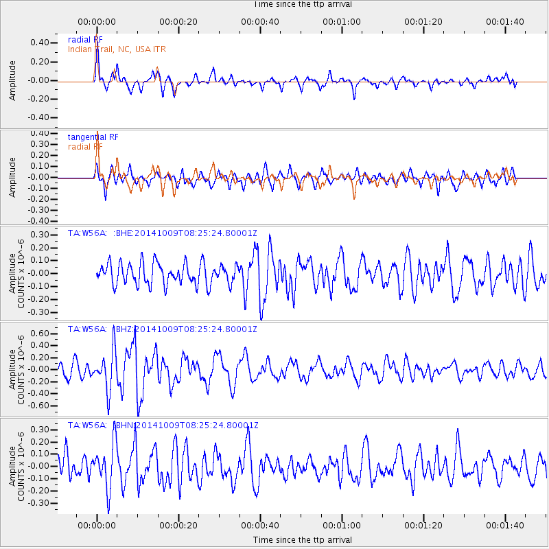
W56A Indian Trail, NC, USA - Earthquake Result Viewer
*The percent match for this event was below the threshold and hence no stack was calculated.
| Earthquake location: |
Southern East Pacific Rise |
| Earthquake latitude/longitude: |
-32.7/-111.6 |
| Earthquake time(UTC): |
2014/10/09 (282) 08:14:23 GMT |
| Earthquake Depth: |
10 km |
| Earthquake Magnitude: |
5.6 MB |
| Earthquake Catalog/Contributor: |
NEIC PDE/NEIC COMCAT |
|
| Network: |
TA USArray Transportable Network (new EarthScope stations) |
| Station: |
W56A Indian Trail, NC, USA |
| Lat/Lon: |
35.13 N/80.58 W |
| Elevation: |
177 m |
|
| Distance: |
73.5 deg |
| Az: |
26.165 deg |
| Baz: |
206.987 deg |
| Ray Param: |
$rayparam |
*The percent match for this event was below the threshold and hence was not used in the summary stack. |
|
| Radial Match: |
73.11928 % |
| Radial Bump: |
400 |
| Transverse Match: |
73.01566 % |
| Transverse Bump: |
400 |
| SOD ConfigId: |
803114 |
| Insert Time: |
2014-10-23 08:47:56.265 +0000 |
| GWidth: |
2.5 |
| Max Bumps: |
400 |
| Tol: |
0.001 |
|
Signal To Noise
| Channel | StoN | STA | LTA |
| TA:W56A: :BHZ:20141009T08:25:24.80001Z | 3.5889633 | 3.3023397E-7 | 9.201376E-8 |
| TA:W56A: :BHN:20141009T08:25:24.80001Z | 2.5887353 | 1.8954705E-7 | 7.3219944E-8 |
| TA:W56A: :BHE:20141009T08:25:24.80001Z | 0.7799315 | 6.202762E-8 | 7.952957E-8 |
| Arrivals |
| Ps | |
| PpPs | |
| PsPs/PpSs | |


