You are here: Home > Network List > TA - USArray Transportable Network (new EarthScope stations) Stations List
> Station W59A Clinton, NC, USA > Earthquake Result Viewer
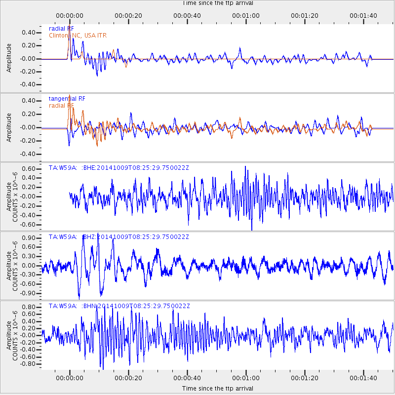
W59A Clinton, NC, USA - Earthquake Result Viewer
*The percent match for this event was below the threshold and hence no stack was calculated.
| Earthquake location: |
Southern East Pacific Rise |
| Earthquake latitude/longitude: |
-32.7/-111.6 |
| Earthquake time(UTC): |
2014/10/09 (282) 08:14:23 GMT |
| Earthquake Depth: |
10 km |
| Earthquake Magnitude: |
5.6 MB |
| Earthquake Catalog/Contributor: |
NEIC PDE/NEIC COMCAT |
|
| Network: |
TA USArray Transportable Network (new EarthScope stations) |
| Station: |
W59A Clinton, NC, USA |
| Lat/Lon: |
35.17 N/78.44 W |
| Elevation: |
60 m |
|
| Distance: |
74.3 deg |
| Az: |
27.763 deg |
| Baz: |
208.657 deg |
| Ray Param: |
$rayparam |
*The percent match for this event was below the threshold and hence was not used in the summary stack. |
|
| Radial Match: |
63.478992 % |
| Radial Bump: |
400 |
| Transverse Match: |
63.37326 % |
| Transverse Bump: |
400 |
| SOD ConfigId: |
803114 |
| Insert Time: |
2014-10-23 08:48:02.166 +0000 |
| GWidth: |
2.5 |
| Max Bumps: |
400 |
| Tol: |
0.001 |
|
Signal To Noise
| Channel | StoN | STA | LTA |
| TA:W59A: :BHZ:20141009T08:25:29.750022Z | 3.1035128 | 4.773852E-7 | 1.538209E-7 |
| TA:W59A: :BHN:20141009T08:25:29.750022Z | 1.4432784 | 2.1811735E-7 | 1.5112632E-7 |
| TA:W59A: :BHE:20141009T08:25:29.750022Z | 0.98170775 | 1.4728515E-7 | 1.5002954E-7 |
| Arrivals |
| Ps | |
| PpPs | |
| PsPs/PpSs | |


