You are here: Home > Network List > US - United States National Seismic Network Stations List
> Station AMTX Amarillo, Texas, USA > Earthquake Result Viewer
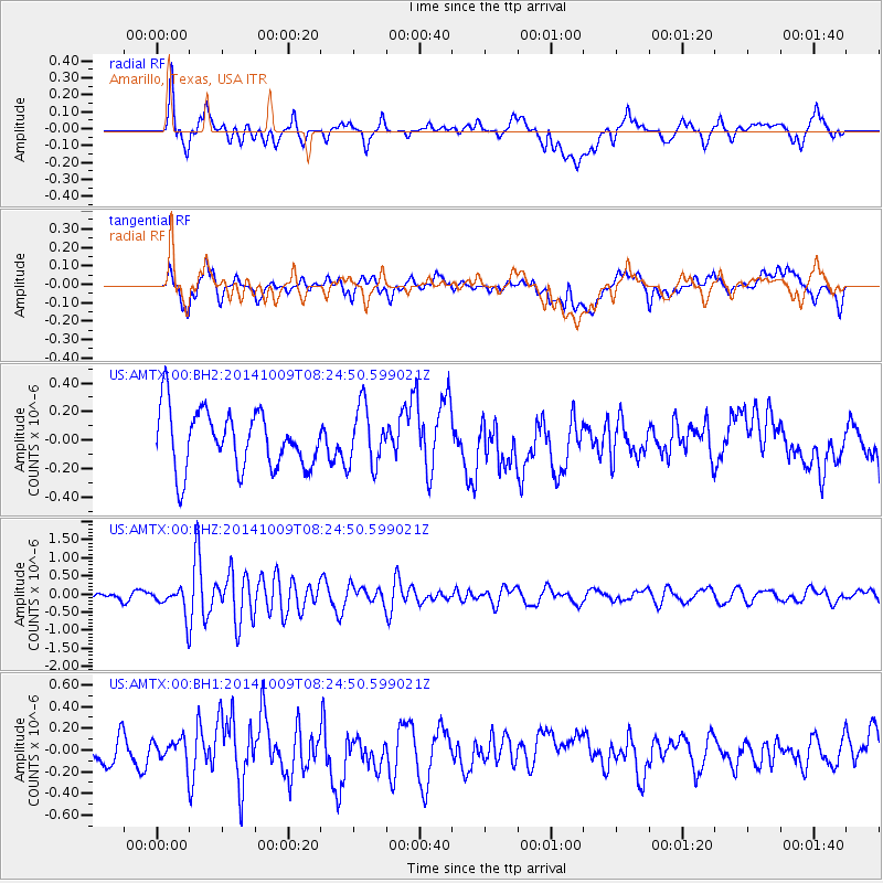
AMTX Amarillo, Texas, USA - Earthquake Result Viewer
*The percent match for this event was below the threshold and hence no stack was calculated.
| Earthquake location: |
Southern East Pacific Rise |
| Earthquake latitude/longitude: |
-32.7/-111.6 |
| Earthquake time(UTC): |
2014/10/09 (282) 08:14:23 GMT |
| Earthquake Depth: |
10 km |
| Earthquake Magnitude: |
5.6 MB |
| Earthquake Catalog/Contributor: |
NEIC PDE/NEIC COMCAT |
|
| Network: |
US United States National Seismic Network |
| Station: |
AMTX Amarillo, Texas, USA |
| Lat/Lon: |
34.53 N/101.41 W |
| Elevation: |
1010 m |
|
| Distance: |
67.5 deg |
| Az: |
9.124 deg |
| Baz: |
189.323 deg |
| Ray Param: |
$rayparam |
*The percent match for this event was below the threshold and hence was not used in the summary stack. |
|
| Radial Match: |
66.70578 % |
| Radial Bump: |
400 |
| Transverse Match: |
55.084194 % |
| Transverse Bump: |
400 |
| SOD ConfigId: |
803114 |
| Insert Time: |
2014-10-23 08:49:15.859 +0000 |
| GWidth: |
2.5 |
| Max Bumps: |
400 |
| Tol: |
0.001 |
|
Signal To Noise
| Channel | StoN | STA | LTA |
| US:AMTX:00:BHZ:20141009T08:24:50.599021Z | 3.6777968 | 4.055857E-7 | 1.1027953E-7 |
| US:AMTX:00:BH1:20141009T08:24:50.599021Z | 0.8544735 | 1.1537309E-7 | 1.3502243E-7 |
| US:AMTX:00:BH2:20141009T08:24:50.599021Z | 0.99268246 | 2.0412656E-7 | 2.0563128E-7 |
| Arrivals |
| Ps | |
| PpPs | |
| PsPs/PpSs | |


