You are here: Home > Network List > US - United States National Seismic Network Stations List
> Station DGMT Dagmar, Montana, USA > Earthquake Result Viewer
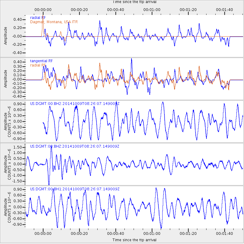
DGMT Dagmar, Montana, USA - Earthquake Result Viewer
*The percent match for this event was below the threshold and hence no stack was calculated.
| Earthquake location: |
Southern East Pacific Rise |
| Earthquake latitude/longitude: |
-32.7/-111.6 |
| Earthquake time(UTC): |
2014/10/09 (282) 08:14:23 GMT |
| Earthquake Depth: |
10 km |
| Earthquake Magnitude: |
5.6 MB |
| Earthquake Catalog/Contributor: |
NEIC PDE/NEIC COMCAT |
|
| Network: |
US United States National Seismic Network |
| Station: |
DGMT Dagmar, Montana, USA |
| Lat/Lon: |
48.47 N/104.20 W |
| Elevation: |
0.0 m |
|
| Distance: |
81.0 deg |
| Az: |
5.002 deg |
| Baz: |
186.345 deg |
| Ray Param: |
$rayparam |
*The percent match for this event was below the threshold and hence was not used in the summary stack. |
|
| Radial Match: |
62.05851 % |
| Radial Bump: |
400 |
| Transverse Match: |
49.088497 % |
| Transverse Bump: |
384 |
| SOD ConfigId: |
803114 |
| Insert Time: |
2014-10-23 08:49:39.250 +0000 |
| GWidth: |
2.5 |
| Max Bumps: |
400 |
| Tol: |
0.001 |
|
Signal To Noise
| Channel | StoN | STA | LTA |
| US:DGMT:00:BHZ:20141009T08:26:07.149009Z | 3.4189713 | 8.2275E-7 | 2.4064255E-7 |
| US:DGMT:00:BH1:20141009T08:26:07.149009Z | 0.575 | 2.1439511E-7 | 3.7286108E-7 |
| US:DGMT:00:BH2:20141009T08:26:07.149009Z | 0.95793885 | 4.576456E-7 | 4.777399E-7 |
| Arrivals |
| Ps | |
| PpPs | |
| PsPs/PpSs | |


