You are here: Home > Network List > UW - Pacific Northwest Regional Seismic Network Stations List
> Station MRBL Marblemount, WA, USA > Earthquake Result Viewer
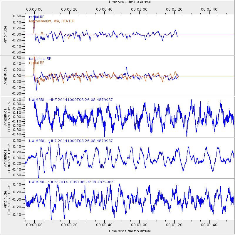
MRBL Marblemount, WA, USA - Earthquake Result Viewer
*The percent match for this event was below the threshold and hence no stack was calculated.
| Earthquake location: |
Southern East Pacific Rise |
| Earthquake latitude/longitude: |
-32.7/-111.6 |
| Earthquake time(UTC): |
2014/10/09 (282) 08:14:23 GMT |
| Earthquake Depth: |
10 km |
| Earthquake Magnitude: |
5.6 MB |
| Earthquake Catalog/Contributor: |
NEIC PDE/NEIC COMCAT |
|
| Network: |
UW Pacific Northwest Regional Seismic Network |
| Station: |
MRBL Marblemount, WA, USA |
| Lat/Lon: |
48.52 N/121.48 W |
| Elevation: |
75 m |
|
| Distance: |
81.3 deg |
| Az: |
353.391 deg |
| Baz: |
171.604 deg |
| Ray Param: |
$rayparam |
*The percent match for this event was below the threshold and hence was not used in the summary stack. |
|
| Radial Match: |
67.984436 % |
| Radial Bump: |
400 |
| Transverse Match: |
80.23239 % |
| Transverse Bump: |
400 |
| SOD ConfigId: |
803114 |
| Insert Time: |
2014-10-23 08:52:35.160 +0000 |
| GWidth: |
2.5 |
| Max Bumps: |
400 |
| Tol: |
0.001 |
|
Signal To Noise
| Channel | StoN | STA | LTA |
| UW:MRBL: :HHZ:20141009T08:26:08.487998Z | 2.237155 | 2.7966863E-7 | 1.2501084E-7 |
| UW:MRBL: :HHN:20141009T08:26:08.487998Z | 0.6052123 | 9.1841976E-8 | 1.5175168E-7 |
| UW:MRBL: :HHE:20141009T08:26:08.487998Z | 0.84918135 | 1.2108714E-7 | 1.4259278E-7 |
| Arrivals |
| Ps | |
| PpPs | |
| PsPs/PpSs | |


