You are here: Home > Network List > WY - Yellowstone Wyoming Seismic Network Stations List
> Station YHH Holmes Hill, YNP, WY, USA > Earthquake Result Viewer
YHH Holmes Hill, YNP, WY, USA - Earthquake Result Viewer
*The percent match for this event was below the threshold and hence no stack was calculated.
| Earthquake location: |
Southern East Pacific Rise |
| Earthquake latitude/longitude: |
-32.7/-111.6 |
| Earthquake time(UTC): |
2014/10/09 (282) 08:14:23 GMT |
| Earthquake Depth: |
10 km |
| Earthquake Magnitude: |
5.6 MB |
| Earthquake Catalog/Contributor: |
NEIC PDE/NEIC COMCAT |
|
| Network: |
WY Yellowstone Wyoming Seismic Network |
| Station: |
YHH Holmes Hill, YNP, WY, USA |
| Lat/Lon: |
44.79 N/110.85 W |
| Elevation: |
2717 m |
|
| Distance: |
77.1 deg |
| Az: |
0.571 deg |
| Baz: |
180.676 deg |
| Ray Param: |
$rayparam |
*The percent match for this event was below the threshold and hence was not used in the summary stack. |
|
| Radial Match: |
57.21779 % |
| Radial Bump: |
369 |
| Transverse Match: |
70.19288 % |
| Transverse Bump: |
400 |
| SOD ConfigId: |
803114 |
| Insert Time: |
2014-10-23 08:54:25.525 +0000 |
| GWidth: |
2.5 |
| Max Bumps: |
400 |
| Tol: |
0.001 |
|
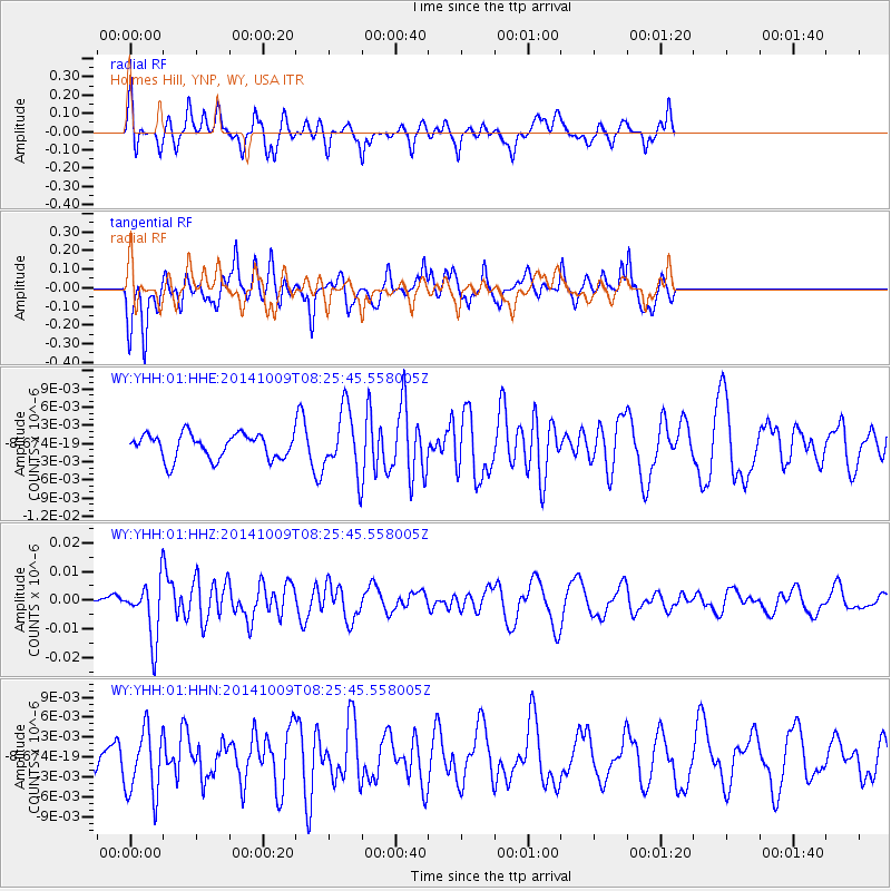
Signal To Noise
| Channel | StoN | STA | LTA |
| WY:YHH:01:HHZ:20141009T08:25:45.558005Z | 4.6569753 | 9.87699E-9 | 2.1209021E-9 |
| WY:YHH:01:HHN:20141009T08:25:45.558005Z | 2.3508317 | 4.996935E-9 | 2.1256028E-9 |
| WY:YHH:01:HHE:20141009T08:25:45.558005Z | 2.5246525 | 5.1542126E-9 | 2.0415534E-9 |
| Arrivals |
| Ps | |
| PpPs | |
| PsPs/PpSs | |


