
GRFO Grafenberg, Germany - Earthquake Result Viewer

| ||||||||||||||||||
| ||||||||||||||||||
| ||||||||||||||||||
|
Signal To Noise
| Channel | StoN | STA | LTA |
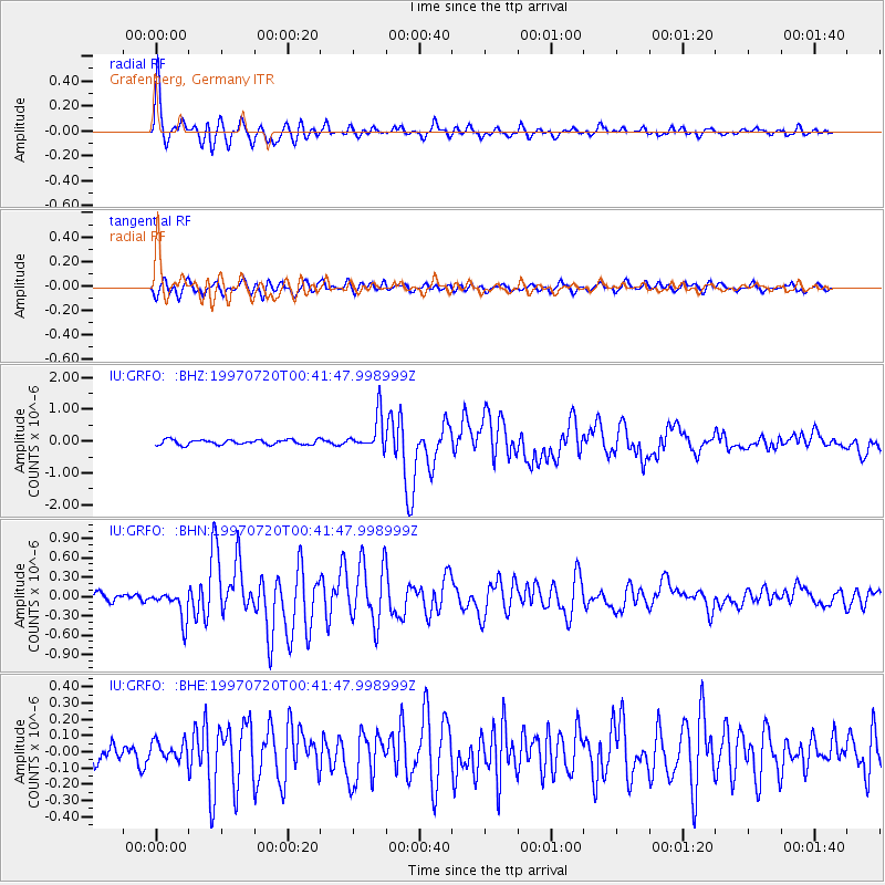
| IU:GRFO: :BHN:19970720T00:41:47.998999Z | 3.10214 | 2.3308077E-7 | 7.5135475E-8 |
| IU:GRFO: :BHE:19970720T00:41:47.998999Z | 0.9581614 | 5.778462E-8 | 6.030781E-8 |
| IU:GRFO: :BHZ:19970720T00:41:47.998999Z | 7.042318 | 5.411727E-7 | 7.684582E-8 |
| Arrivals | |
| Ps | 4.0 SECOND |
| PpPs | 13 SECOND |
| PsPs/PpSs | 17 SECOND |

