GRFO Grafenberg, Germany - Earthquake Result Viewer
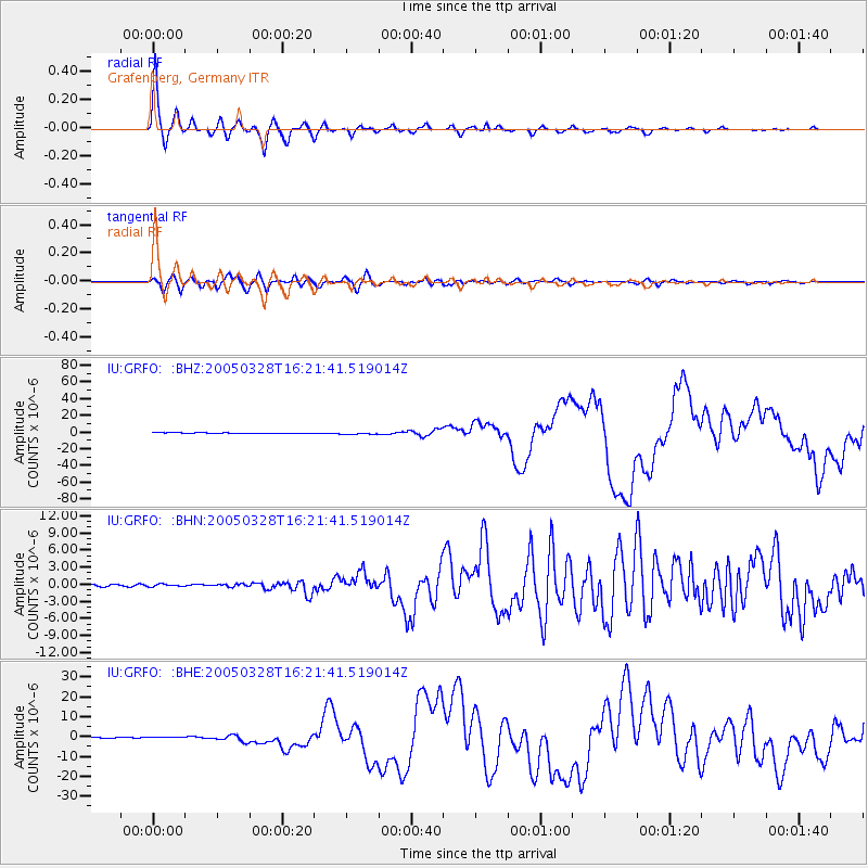
Earthquake location: Northern Sumatra, Indonesia
Earthquake latitude/longitude: 2.1/97.1
Earthquake time(UTC): 2005/03/28 (087) 16:09:36 GMT
Earthquake Depth: 30 km
Earthquake Magnitude: 7.2 MB, 8.4 MS, 8.7 MW, 8.1 MW
Earthquake Catalog/Contributor: WHDF/NEIC
Network: IU Global Seismograph Network (GSN - IRIS/USGS)
Station: GRFO Grafenberg, Germany
Lat/Lon: 49.69 N/11.22 E
Elevation: 425 m
Distance: 85.8 deg
Az: 319.494 deg
Baz: 91.784 deg
Ray Param: 0.04450071
Estimated Moho Depth: 31.0 km
Estimated Crust Vp/Vs: 1.75
Assumed Crust Vp: 6.182 km/s
Estimated Crust Vs: 3.533 km/s
Estimated Crust Poisson's Ratio: 0.26
Radial Match: 97.60298 %
Radial Bump: 362
Transverse Match: 87.4529 %
Transverse Bump: 400
SOD ConfigId: 2459
Insert Time: 2010-03-02 02:17:50.365 +0000
GWidth: 2.5
Max Bumps: 400
Tol: 0.001

Signal To Noise

ChannelStoNSTALTA
IU:GRFO: :BHN:20050328T16:21:41.519014Z1.61444992.1892511E-71.3560353E-7
IU:GRFO: :BHE:20050328T16:21:41.519014Z3.09223274.9809586E-71.610797E-7
IU:GRFO: :BHZ:20050328T16:21:41.519014Z4.0136491.1857495E-62.9542932E-7
Arrivals
Ps3.8 SECOND
PpPs13 SECOND
PsPs/PpSs17 SECOND