
GRFO Grafenberg, Germany - Earthquake Result Viewer
| ||||||||||||||||||
| ||||||||||||||||||
| ||||||||||||||||||
|
Signal To Noise
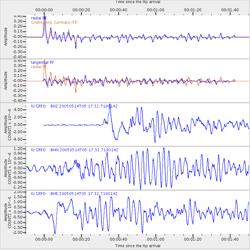
| Channel | StoN | STA | LTA |
| IU:GRFO: :BHN:20050514T05:17:32.719014Z | 1.173759 | 1.1276736E-7 | 9.607369E-8 |
| IU:GRFO: :BHE:20050514T05:17:32.719014Z | 3.3970952 | 3.0481303E-7 | 8.972755E-8 |
| IU:GRFO: :BHZ:20050514T05:17:32.719014Z | 20.957336 | 1.031386E-6 | 4.9213604E-8 |
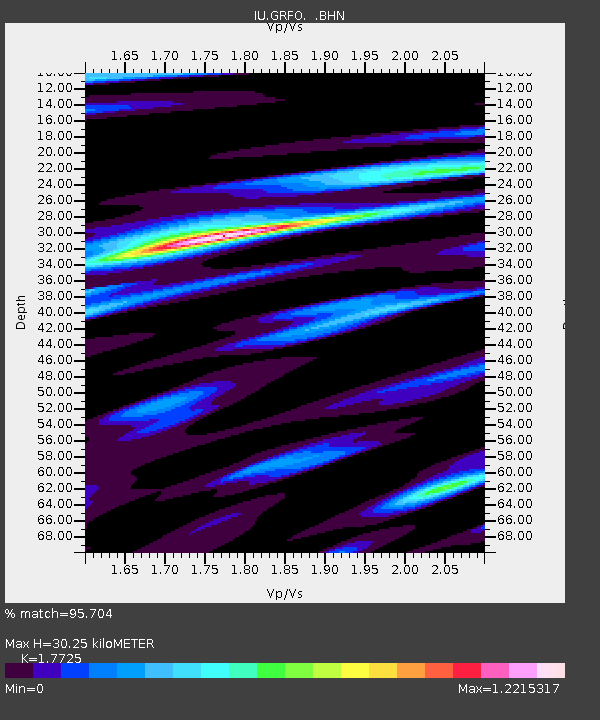
| Arrivals | |
| Ps | 3.9 SECOND |
| PpPs | 13 SECOND |
| PsPs/PpSs | 17 SECOND |

