You are here: Home > Network List > TA - USArray Transportable Network (new EarthScope stations) Stations List
> Station T54A Tazewell, VA, USA > Earthquake Result Viewer
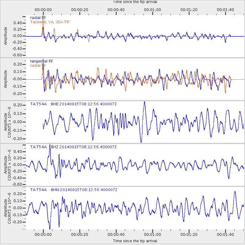
T54A Tazewell, VA, USA - Earthquake Result Viewer
*The percent match for this event was below the threshold and hence no stack was calculated.
| Earthquake location: |
Iceland |
| Earthquake latitude/longitude: |
64.6/-17.4 |
| Earthquake time(UTC): |
2014/09/15 (258) 08:05:02 GMT |
| Earthquake Depth: |
10 km |
| Earthquake Magnitude: |
5.5 MWW, 5.5 MWC |
| Earthquake Catalog/Contributor: |
NEIC PDE/NEIC COMCAT |
|
| Network: |
TA USArray Transportable Network (new EarthScope stations) |
| Station: |
T54A Tazewell, VA, USA |
| Lat/Lon: |
37.06 N/81.58 W |
| Elevation: |
852 m |
|
| Distance: |
46.2 deg |
| Az: |
265.628 deg |
| Baz: |
32.567 deg |
| Ray Param: |
$rayparam |
*The percent match for this event was below the threshold and hence was not used in the summary stack. |
|
| Radial Match: |
61.440464 % |
| Radial Bump: |
400 |
| Transverse Match: |
51.921387 % |
| Transverse Bump: |
400 |
| SOD ConfigId: |
803114 |
| Insert Time: |
2014-10-23 13:07:30.171 +0000 |
| GWidth: |
2.5 |
| Max Bumps: |
400 |
| Tol: |
0.001 |
|
Signal To Noise
| Channel | StoN | STA | LTA |
| TA:T54A: :BHZ:20140915T08:12:56.400007Z | 3.3661401 | 2.3173824E-7 | 6.88439E-8 |
| TA:T54A: :BHN:20140915T08:12:56.400007Z | 1.5901498 | 1.2897566E-7 | 8.110913E-8 |
| TA:T54A: :BHE:20140915T08:12:56.400007Z | 1.1615412 | 7.442837E-8 | 6.407725E-8 |
| Arrivals |
| Ps | |
| PpPs | |
| PsPs/PpSs | |


