GRFO Grafenberg, Germany - Earthquake Result Viewer
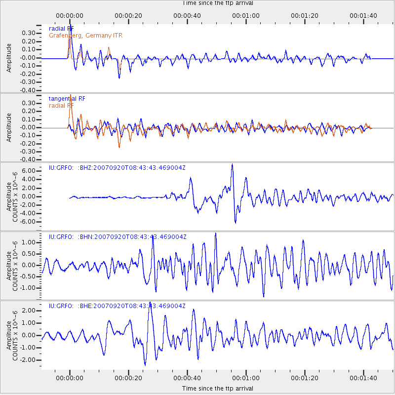
Earthquake location: Southern Sumatra, Indonesia
Earthquake latitude/longitude: -2.0/100.1
Earthquake time(UTC): 2007/09/20 (263) 08:31:14 GMT
Earthquake Depth: 30 km
Earthquake Magnitude: 6.3 MB, 6.8 MS, 6.7 MW, 6.3 ME
Earthquake Catalog/Contributor: WHDF/NEIC
Network: IU Global Seismograph Network (GSN - IRIS/USGS)
Station: GRFO Grafenberg, Germany
Lat/Lon: 49.69 N/11.22 E
Elevation: 384 m
Distance: 90.8 deg
Az: 319.505 deg
Baz: 92.11 deg
Ray Param: 0.041643478
Estimated Moho Depth: 30.0 km
Estimated Crust Vp/Vs: 1.78
Assumed Crust Vp: 6.182 km/s
Estimated Crust Vs: 3.478 km/s
Estimated Crust Poisson's Ratio: 0.27
Radial Match: 94.3424 %
Radial Bump: 357
Transverse Match: 87.78247 %
Transverse Bump: 400
SOD ConfigId: 2564
Insert Time: 2010-03-02 02:18:44.707 +0000
GWidth: 2.5
Max Bumps: 400
Tol: 0.001

Signal To Noise

ChannelStoNSTALTA
IU:GRFO: :BHN:20070920T08:43:43.469004Z0.51737329.8500394E-81.9038558E-7
IU:GRFO: :BHE:20070920T08:43:43.469004Z1.7265273.142567E-71.8201668E-7
IU:GRFO: :BHZ:20070920T08:43:43.469004Z2.54072673.071202E-71.2087888E-7
Arrivals
Ps3.8 SECOND
PpPs13 SECOND
PsPs/PpSs17 SECOND