You are here: Home > Network List > TA - USArray Transportable Network (new EarthScope stations) Stations List
> Station V60A Jim Taylor Road, Stokes, NC, USA > Earthquake Result Viewer
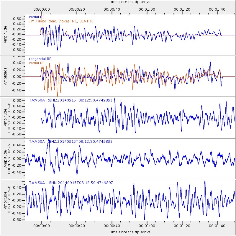
V60A Jim Taylor Road, Stokes, NC, USA - Earthquake Result Viewer
*The percent match for this event was below the threshold and hence no stack was calculated.
| Earthquake location: |
Iceland |
| Earthquake latitude/longitude: |
64.6/-17.4 |
| Earthquake time(UTC): |
2014/09/15 (258) 08:05:02 GMT |
| Earthquake Depth: |
10 km |
| Earthquake Magnitude: |
5.5 MWW, 5.5 MWC |
| Earthquake Catalog/Contributor: |
NEIC PDE/NEIC COMCAT |
|
| Network: |
TA USArray Transportable Network (new EarthScope stations) |
| Station: |
V60A Jim Taylor Road, Stokes, NC, USA |
| Lat/Lon: |
35.76 N/77.26 W |
| Elevation: |
8.0 m |
|
| Distance: |
45.5 deg |
| Az: |
260.562 deg |
| Baz: |
31.588 deg |
| Ray Param: |
$rayparam |
*The percent match for this event was below the threshold and hence was not used in the summary stack. |
|
| Radial Match: |
61.57208 % |
| Radial Bump: |
400 |
| Transverse Match: |
50.842926 % |
| Transverse Bump: |
400 |
| SOD ConfigId: |
803114 |
| Insert Time: |
2014-10-23 13:08:26.238 +0000 |
| GWidth: |
2.5 |
| Max Bumps: |
400 |
| Tol: |
0.001 |
|
Signal To Noise
| Channel | StoN | STA | LTA |
| TA:V60A: :BHZ:20140915T08:12:50.474989Z | 2.9564497 | 2.8565063E-7 | 9.661948E-8 |
| TA:V60A: :BHN:20140915T08:12:50.474989Z | 1.2591562 | 2.639254E-7 | 2.0960496E-7 |
| TA:V60A: :BHE:20140915T08:12:50.474989Z | 1.2661965 | 2.3623818E-7 | 1.8657308E-7 |
| Arrivals |
| Ps | |
| PpPs | |
| PsPs/PpSs | |


