GRFO Grafenberg, Germany - Earthquake Result Viewer
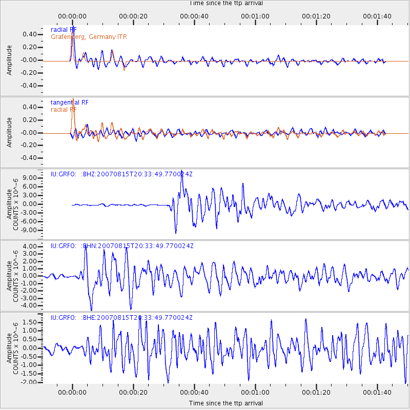
Earthquake location: Andreanof Islands, Aleutian Is.
Earthquake latitude/longitude: 50.3/-177.5
Earthquake time(UTC): 2007/08/15 (227) 20:22:11 GMT
Earthquake Depth: 9.0 km
Earthquake Magnitude: 6.3 MB, 6.2 MS, 6.4 MW, 5.9 ML
Earthquake Catalog/Contributor: WHDF/NEIC
Network: IU Global Seismograph Network (GSN - IRIS/USGS)
Station: GRFO Grafenberg, Germany
Lat/Lon: 49.69 N/11.22 E
Elevation: 384 m
Distance: 80.1 deg
Az: 354.232 deg
Baz: 5.693 deg
Ray Param: 0.04852068
Estimated Moho Depth: 28.25 km
Estimated Crust Vp/Vs: 1.94
Assumed Crust Vp: 6.182 km/s
Estimated Crust Vs: 3.187 km/s
Estimated Crust Poisson's Ratio: 0.32
Radial Match: 94.53863 %
Radial Bump: 400
Transverse Match: 88.43545 %
Transverse Bump: 400
SOD ConfigId: 2564
Insert Time: 2010-03-02 02:19:39.737 +0000
GWidth: 2.5
Max Bumps: 400
Tol: 0.001

Signal To Noise

ChannelStoNSTALTA
IU:GRFO: :BHN:20070815T20:33:49.770024Z5.24358561.4082481E-62.6856586E-7
IU:GRFO: :BHE:20070815T20:33:49.770024Z1.04767451.9338323E-71.8458331E-7
IU:GRFO: :BHZ:20070815T20:33:49.770024Z18.3483283.157074E-61.720633E-7
Arrivals
Ps4.4 SECOND
PpPs13 SECOND
PsPs/PpSs18 SECOND