GRFO Grafenberg, Germany - Earthquake Result Viewer
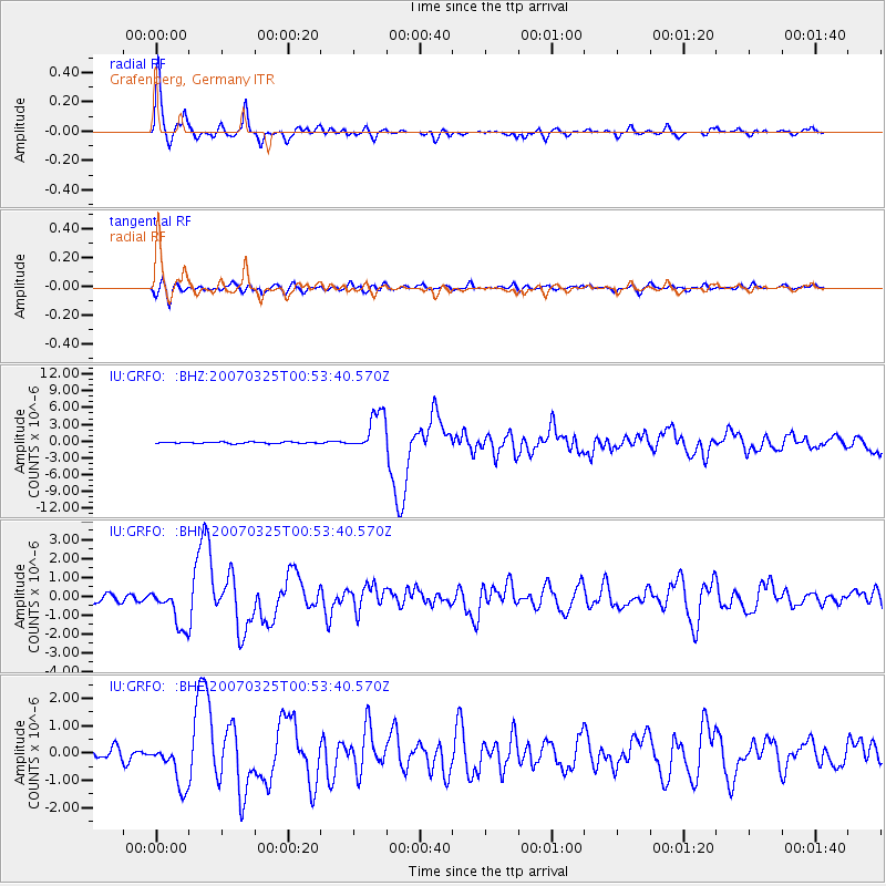
Earthquake location: Near West Coast Of Honshu, Japan
Earthquake latitude/longitude: 37.3/136.6
Earthquake time(UTC): 2007/03/25 (084) 00:41:57 GMT
Earthquake Depth: 8.0 km
Earthquake Magnitude: 6.1 MB, 6.8 MS, 6.7 MW, 6.6 MW
Earthquake Catalog/Contributor: WHDF/NEIC
Network: IU Global Seismograph Network (GSN - IRIS/USGS)
Station: GRFO Grafenberg, Germany
Lat/Lon: 49.69 N/11.22 E
Elevation: 384 m
Distance: 80.8 deg
Az: 327.557 deg
Baz: 41.178 deg
Ray Param: 0.04802398
Estimated Moho Depth: 30.0 km
Estimated Crust Vp/Vs: 1.87
Assumed Crust Vp: 6.182 km/s
Estimated Crust Vs: 3.306 km/s
Estimated Crust Poisson's Ratio: 0.30
Radial Match: 96.528885 %
Radial Bump: 373
Transverse Match: 79.66961 %
Transverse Bump: 400
SOD ConfigId: 2564
Insert Time: 2010-03-02 02:20:27.909 +0000
GWidth: 2.5
Max Bumps: 400
Tol: 0.001

Signal To Noise

ChannelStoNSTALTA
IU:GRFO: :BHN:20070325T00:53:40.570Z6.2680711.074758E-61.714655E-7
IU:GRFO: :BHE:20070325T00:53:40.570Z4.13901578.180016E-71.976319E-7
IU:GRFO: :BHZ:20070325T00:53:40.570Z28.4817333.5547725E-61.2480886E-7
Arrivals
Ps4.3 SECOND
PpPs14 SECOND
PsPs/PpSs18 SECOND