You are here: Home > Network List > AV - Alaska Volcano Observatory Stations List
> Station MAPS Pakushin Southeast, Makushin Volcano, Alaska > Earthquake Result Viewer
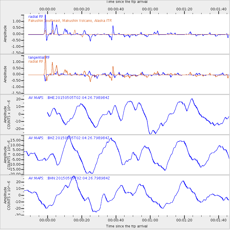
MAPS Pakushin Southeast, Makushin Volcano, Alaska - Earthquake Result Viewer
*The percent match for this event was below the threshold and hence no stack was calculated.
| Earthquake location: |
New Britain Region, P.N.G. |
| Earthquake latitude/longitude: |
-5.3/152.0 |
| Earthquake time(UTC): |
2015/05/05 (125) 01:54:05 GMT |
| Earthquake Depth: |
64 km |
| Earthquake Magnitude: |
5.9 MB |
| Earthquake Catalog/Contributor: |
NEIC PDE/NEIC COMCAT |
|
| Network: |
AV Alaska Volcano Observatory |
| Station: |
MAPS Pakushin Southeast, Makushin Volcano, Alaska |
| Lat/Lon: |
53.81 N/166.94 W |
| Elevation: |
333 m |
|
| Distance: |
68.2 deg |
| Az: |
24.803 deg |
| Baz: |
224.776 deg |
| Ray Param: |
$rayparam |
*The percent match for this event was below the threshold and hence was not used in the summary stack. |
|
| Radial Match: |
68.41706 % |
| Radial Bump: |
400 |
| Transverse Match: |
65.08691 % |
| Transverse Bump: |
400 |
| SOD ConfigId: |
7422571 |
| Insert Time: |
2019-04-18 16:06:58.264 +0000 |
| GWidth: |
2.5 |
| Max Bumps: |
400 |
| Tol: |
0.001 |
|
Signal To Noise
| Channel | StoN | STA | LTA |
| AV:MAPS: :BHZ:20150505T02:04:26.798984Z | 0.44994447 | 2.718499E-6 | 6.0418547E-6 |
| AV:MAPS: :BHN:20150505T02:04:26.798984Z | 4.3039145 | 1.6097318E-5 | 3.7401571E-6 |
| AV:MAPS: :BHE:20150505T02:04:26.798984Z | 0.48710892 | 3.938132E-6 | 8.084706E-6 |
| Arrivals |
| Ps | |
| PpPs | |
| PsPs/PpSs | |


