
GRFO Grafenberg, Germany - Earthquake Result Viewer
| ||||||||||||||||||
| ||||||||||||||||||
| ||||||||||||||||||
|
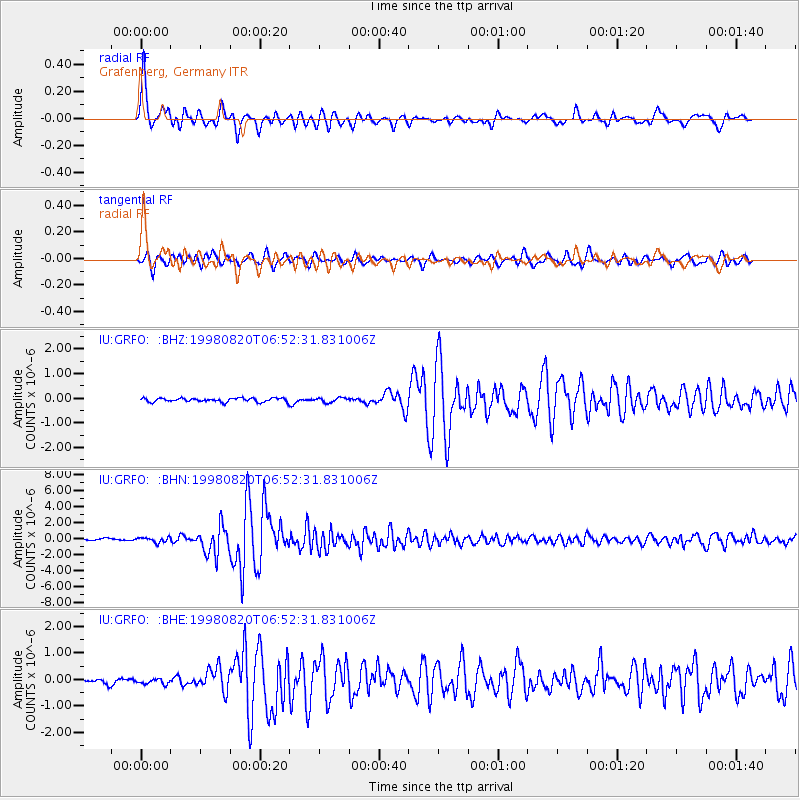
Signal To Noise
| Channel | StoN | STA | LTA |
| IU:GRFO: :BHN:19980820T06:52:31.831006Z | 3.3691394 | 3.0883385E-7 | 9.16655E-8 |
| IU:GRFO: :BHE:19980820T06:52:31.831006Z | 1.1036403 | 9.907089E-8 | 8.976736E-8 |
| IU:GRFO: :BHZ:19980820T06:52:31.831006Z | 1.2095308 | 9.206334E-8 | 7.6114915E-8 |
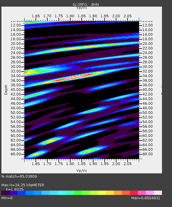
| Arrivals | |
| Ps | 4.6 SECOND |
| PpPs | 15 SECOND |
| PsPs/PpSs | 20 SECOND |

